Geothermal Energy Engineering and Economics
Site Assessment Geology
Finding the Heat
A successful geothermal project begins long before the first drill bit touches the ground. The most critical step is identifying a location with enough accessible heat. We start by looking for anomalies. Earth's temperature increases with depth, a rate known as the geothermal gradient. In most places, this gradient is around 25°C per kilometer. Geothermal hotspots, however, have much steeper gradients, sometimes exceeding 100°C per kilometer.
To find these areas, geologists use heat flow maps. These maps compile temperature data from existing wells, mines, and geological surveys to show regions where the Earth's crust is thinner or more fractured, allowing heat from the mantle to rise closer to the surface. High heat flow, measured in milliwatts per square meter (), is a primary indicator of a viable geothermal resource. This process is essentially a large-scale search for areas where natural convection dominates heat transfer, bringing thermal energy within economic reach.
Reading the Earth's Temperature
Once a promising region is identified, the next step is to estimate the temperature of the deep reservoir without the massive cost of drilling an exploratory well. This is where the chemistry of local water sources becomes a powerful tool.
Hot springs, geysers, and fumaroles at the surface are often fed by the same deep reservoir we want to tap into. As superheated water travels upwards, it dissolves minerals from the surrounding rock. The specific concentration of certain elements, particularly silica (), and the ratios of ions like sodium, potassium, and calcium, are highly dependent on the temperature at which they were dissolved. This technique, called geochemical geothermometry, allows us to use water samples from a surface spring to predict the temperature of the geothermal reservoir miles below.
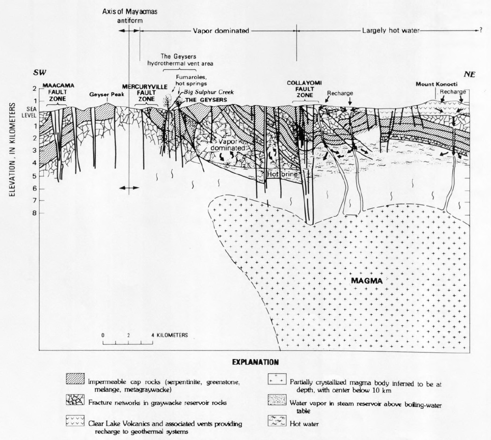
For example, the solubility of quartz is well-understood and directly correlates with temperature. By measuring the amount of dissolved silica in a water sample, we can work backward to calculate the original reservoir temperature. Different mineral pairs, or geothermometers, work best for different temperature ranges, so multiple tests are often run to build a confident temperature model.
Seeing Underground
Geochemistry gives us the 'what' (temperature), but geophysical surveys give us the 'where' (structure). To build a 3D model of the subsurface, we use techniques that are similar to medical imaging. These methods let us map rock layers, faults, and fluid-filled pockets without drilling.
Seismic surveys are crucial. Just like in oil and gas exploration, we generate sound waves at the surface and record the echoes that bounce back from different rock layers. The time it takes for the waves to return helps us map the depth and shape of underground structures. We're looking for permeable, fractured rock formations that can act as a natural reservoir, capped by an impermeable layer that traps the heat and fluid.
Gravity surveys add another layer of information. Dense, solid rock exerts a slightly stronger gravitational pull than porous, fluid-filled rock. By measuring these tiny variations in gravity across a site, we can identify areas of lower density that might indicate a productive geothermal reservoir.
Finally, are used to measure the electrical resistivity of the rock. Water, especially hot, salty brine, is a much better conductor of electricity than solid rock. MT surveys use natural variations in the Earth's magnetic and electric fields to detect these deep, conductive zones. A large, low-resistivity anomaly deep underground is a very strong sign of a potential fluid-filled geothermal system.
The Risks of Stimulation
In Enhanced Geothermal Systems (EGS), we don't just find a reservoir, we create one. By injecting water at high pressure, we reopen existing fractures in hot, dry rock, creating pathways for water to circulate and collect heat. This process, known as hydraulic stimulation, carries the risk of —small, human-caused earthquakes.
The fluid pressure acts to unclamp pre-existing, locked faults in the rock, allowing them to slip. While the vast majority of these events are microseismic, too small to be felt at the surface, the potential for larger, noticeable tremors must be carefully managed. This is where a deep understanding of the local geology and stress fields is non-negotiable.
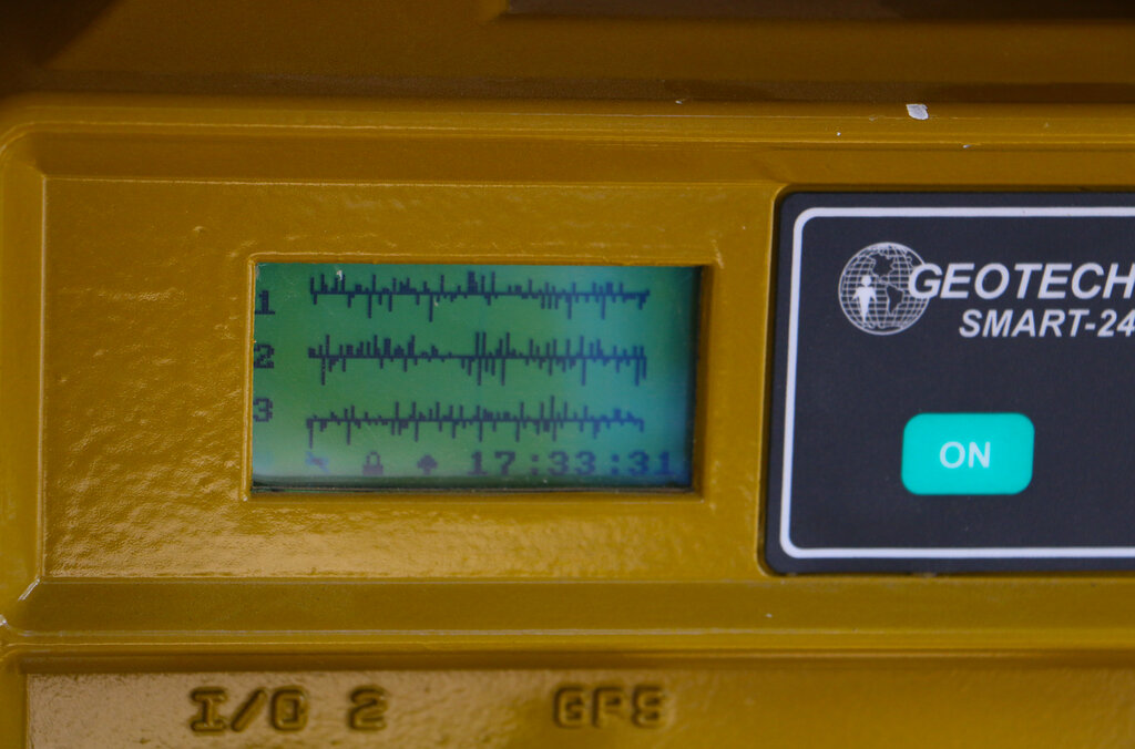
Mitigation involves a 'traffic light' system. A dense network of seismometers is installed around the site before stimulation begins to establish a baseline of natural seismic activity. During injection, this network is monitored in real-time. If seismic events exceed a low threshold (yellow light), injection rates are reduced. If they hit a higher, but still safe, threshold (red light), operations are stopped immediately. By carefully controlling injection pressures and volumes, and by choosing sites away from major, active faults, the risk of felt seismic events can be effectively managed.
All this data, from heat flow maps to seismic surveys and geothermometry, is integrated into a comprehensive thermogeological model. This model is the final product of the site assessment phase. It represents our best hypothesis of the subsurface—the size, temperature, and permeability of the target reservoir. It’s this model that gives a company the confidence to invest millions of dollars in drilling the first production well.
What is the typical geothermal gradient in most non-geothermal areas?
Which scientific technique analyzes the mineral content of hot springs to predict the temperature of the deep underground reservoir?