Your Guide to Stargazing
Understanding the Night Sky
The Sky's Imaginary Dome
To make sense of the night sky, astronomers have long used a helpful concept: the celestial sphere. Imagine Earth is at the center of a gigantic, hollow globe. All the stars, planets, and galaxies are painted on the inside surface of this globe. This isn't how space is actually arranged, of course, but it's a powerful model for mapping the sky as we see it from our planet.
Just like Earth has a North Pole, South Pole, and an equator, the celestial sphere has corresponding points. If you extend Earth's axis of rotation out into space, it would pierce the celestial sphere at the north and south celestial poles. The North Star, Polaris, happens to be very close to the north celestial pole. Similarly, if you project Earth's equator outward, you get the celestial equator, a great circle that wraps around the sky.
Cosmic Coordinates
Once we have this imaginary sphere, we need a coordinate system to pinpoint any object on it. This system works much like latitude and longitude on Earth.
Declination (Dec) is the celestial equivalent of latitude. It measures how far north or south an object is from the celestial equator. It's measured in degrees, from +90° at the north celestial pole to -90° at the south celestial pole. The celestial equator is at 0° declination.
Right Ascension (RA) is the celestial version of longitude. It measures an object's east-west position. Instead of degrees, it's measured in hours, minutes, and seconds, from 0 to 24 hours. This might seem odd, but it relates directly to the time it takes Earth to rotate.
Think of it this way: Declination tells you how high to aim your telescope, and Right Ascension tells you where to point it along the horizon.
Every star and galaxy has a fixed RA and Dec coordinate, just like every city on Earth has a fixed longitude and latitude. These coordinates are what you'll find on star charts.
The Moving Sky
If you watch the sky for a few hours, you'll notice the stars moving. This is the apparent motion of the stars, caused by Earth's rotation. Just as the Sun appears to rise in the east and set in the west, so do the stars. They trace arcs across the sky, pivoting around the celestial poles. This is why photos of the night sky with a long exposure show circular star trails.
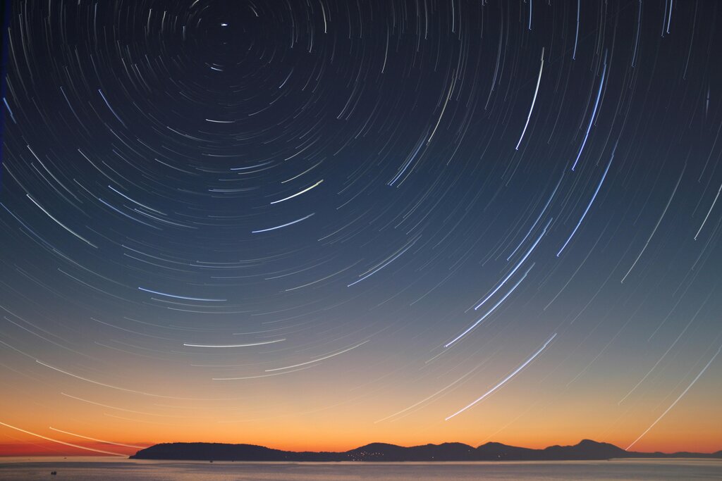
There's also a slower, seasonal change. As Earth orbits the Sun, our nighttime view of the universe shifts. The constellations you see in the winter are different from the ones you see in the summer. This is because the night side of Earth faces a different direction in space depending on the time of year. Each night, the stars rise about four minutes earlier than the night before.
Your Guide to the Stars
So how do you find anything? You use a map, of course. For stargazing, the most common tools are star charts and planispheres.
A star chart is a map of the sky for a specific time and location. It shows constellations, stars, and other objects like nebulae and galaxies, with their RA and Dec coordinates often marked.
A planisphere, or star wheel, is a clever tool that lets you dial in the date and time to see a map of the stars currently visible above you. It consists of two discs fastened at the center. The bottom disc has a star chart, and the top disc has a transparent window representing your horizon. By rotating the discs, you can match the time with the date, revealing the celestial view for that moment.
When using a star chart or planisphere at night, use a red flashlight. Red light doesn't ruin your night vision as much as white light does, allowing your eyes to stay adapted to the dark.
One major challenge for modern stargazers is light pollution. The glow from cities, streetlights, and buildings washes out the fainter stars, making it difficult to see much beyond the brightest objects. Finding a dark location away from city centers will dramatically improve your view of the cosmos. Parks, rural areas, and designated dark-sky preserves are your best bets for a truly spectacular show.

Now, let's test what you've learned about mapping and navigating the night sky.
What is the celestial sphere?
Which celestial coordinate is the equivalent of latitude on Earth and is measured in degrees north or south of the celestial equator?
With these basics, you're ready to start exploring. All it takes is a clear night, a simple star chart, and a little patience.