Spatial Access with the 2SFCA Method
Introduction to Spatial Accessibility
What is Spatial Accessibility?
Spatial accessibility measures how easy it is for people to reach desired services or opportunities. Think about looking for a new apartment. You probably check how long it takes to get to work, the nearest grocery store, or a park. You are, in essence, measuring its accessibility.
More formally, it’s a concept that blends two key ideas: the spatial separation between people and destinations, and the availability of those destinations. It’s not just about how close a hospital is; it’s also about how many people that hospital serves. A nearby clinic isn't very accessible if its appointment book is full for months.
Accessibility isn't a luxury; it's a key ingredient for a city that works for everyone.
Why Accessibility Matters
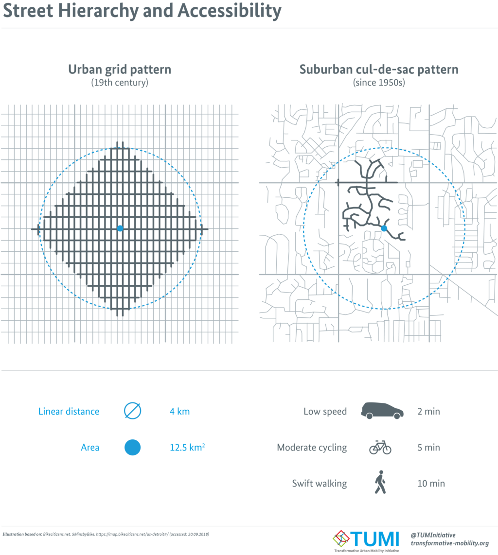
Understanding accessibility is crucial for building fair and functional communities. Urban planners use these insights to make critical decisions. Where should a new bus line go to serve the most people? Is a new housing development located where residents can easily get to jobs and schools? The layout of a city's streets can have a huge impact on how people get around.
An organized street grid, for example, often provides more direct routes and connections than a winding, suburban layout with many dead ends. This affects travel times for everyone, whether they're walking, biking, or driving.
In public health, accessibility can be a matter of life and death. If people in a particular neighborhood live far from a doctor's office or pharmacy, and lack reliable transportation, they are less likely to get preventative care or timely treatment. This is especially true for vulnerable populations like the elderly or low-income families. Health planners use accessibility models to identify these “medical deserts” and figure out where new clinics or services are needed most.
It also has major economic implications. Businesses want to locate where customers can easily reach them. Good accessibility connects people with jobs, boosting economic mobility. It's a fundamental measure of opportunity.
How We Measure It
So how do we turn this concept into a number? Researchers have developed several models to quantify accessibility. Two of the most common traditional approaches are cumulative opportunity models and gravity models.
Cumulative Opportunity
noun
This method counts the number of opportunities (like jobs or doctors) that can be reached within a certain travel time or distance. It's a simple and intuitive approach.
For example, we could ask: how many grocery stores are within a 10-minute walk from a specific address? While easy to understand, this method treats all destinations within the threshold equally and ignores anything just outside of it. A store 9 minutes away counts the same as one 1 minute away, but a store 11 minutes away doesn't count at all.
Gravity Model
noun
Inspired by Newton's law of gravitation, this model assumes the pull, or attractiveness, of a destination increases with its size (e.g., number of doctors) and decreases with distance.
In a gravity model, a large, distant hospital might be considered more accessible than a small, nearby clinic because its size (more services, more specialists) makes it more attractive. This approach captures two important real-world factors: people are willing to travel farther for better opportunities, and bigger destinations draw from a wider area.
The basic formula for a gravity-based accessibility measure () for a location looks something like this:
Here, is the size or capacity of the service at location , is the travel time or distance between location and location , and is a travel friction coefficient. A larger means that distance has a stronger negative effect on accessibility.
These foundational models provide the building blocks for understanding where services are easy to reach and where gaps exist. They help transform planning from guesswork into a data-driven science, allowing us to build more equitable and efficient communities.