Saudi Arabia Revealed
Geography
Where the Kingdom Lies
Saudi Arabia takes up about 80% of the Arabian Peninsula. It’s a huge country, strategically positioned between the Red Sea to the west and the Persian Gulf to the east. This location has been a crossroads for trade and culture for centuries.
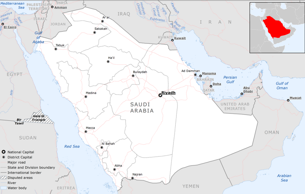
Its long coastlines on two major bodies of water give it significant maritime access. To the north, it shares borders with Jordan and Iraq. To the northeast are Kuwait, Qatar, and the UAE, while Oman and Yemen lie to the south and southeast.
A Land of Plateaus and Deserts
The country's landscape is dominated by a central plateau, known as the Najd, which slopes gently from west to east. Along the Red Sea coast, a mountain range called the Sarawat Mountains runs parallel to the sea. This range includes the Asir region in the southwest, which receives more rainfall than the rest of the country and has cooler temperatures.
But Saudi Arabia is most famous for its deserts. In the north, the An Nafud desert is known for its reddish sand and massive dunes. In the south lies the largest sand desert in the world: the Rub' al Khali, or the "Empty Quarter."
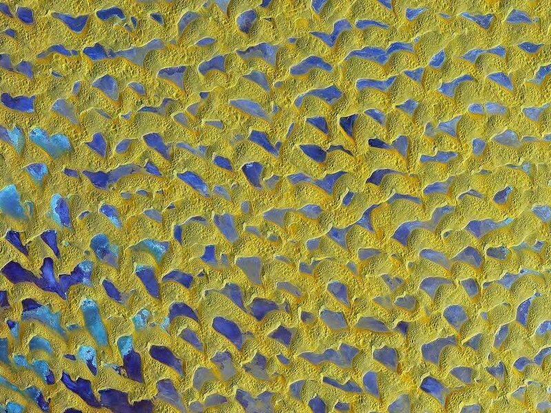
The Rub' al Khali is larger than France and is one of the most inhospitable places on Earth.
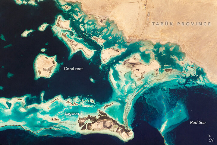
The coastlines offer a stark contrast. The Red Sea coast is fringed with extensive coral reefs and clear waters, while the Persian Gulf coast is characterized by shallow waters, salt flats, and sandy or gravelly plains.
A Hot, Dry Climate
Most of Saudi Arabia has a desert climate. Summers are extremely hot and dry, with daytime temperatures often soaring above 45°C (113°F). Winters are milder, but temperatures can drop significantly, especially at night in the interior deserts. Rainfall is scarce and unpredictable, averaging less than 100 millimeters (4 inches) per year in most regions.
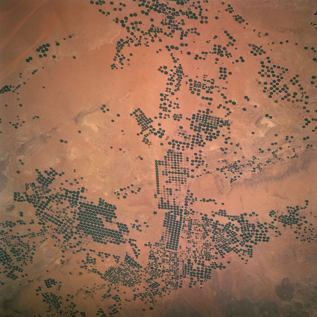
This harsh climate heavily influences where people live. The majority of the population is concentrated in cities along the coasts or in inland oases where water is more accessible. Agriculture is challenging and relies heavily on irrigation, often drawing from underground aquifers—ancient water reserves trapped deep below the desert sand.
Wealth Beneath the Sand
Saudi Arabia’s most significant natural resource is petroleum. The country holds some of the world's largest proven oil reserves, concentrated primarily in the Eastern Province along the Persian Gulf. This immense wealth has transformed the nation's economy and landscape.
In addition to oil, the country has vast reserves of natural gas. Other mineral resources include gold, phosphate, bauxite (for aluminum), copper, and uranium. Water, however, remains the most precious and scarcest resource. To meet demand, Saudi Arabia has become a world leader in desalination, the process of removing salt from seawater to make it drinkable.
Ready to test your knowledge of Saudi Arabia's geography?
Which two major bodies of water border Saudi Arabia?
What is the name of the largest sand desert in the world, located in southern Saudi Arabia?
From its vast deserts to its valuable resources, Saudi Arabia's geography is a story of extremes that has shaped its past and will define its future.