Satellite Imaging Essentials
Introduction to Satellite Imaging
A View from Above
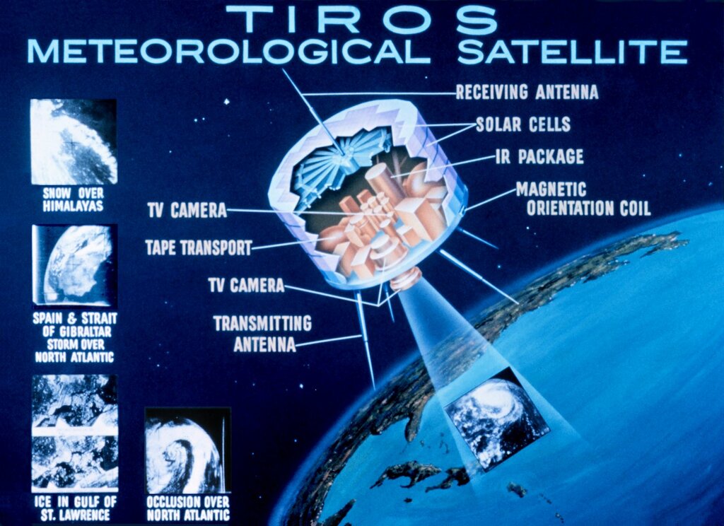
For most of human history, our view of Earth was limited to what we could see from the ground. That all changed in the 20th century. While the first images of Earth from space were taken by rockets in the 1940s, the era of satellite imaging truly began with the launch of NASA's TIROS-1 in 1960. It was the first successful weather satellite, and it sent back a grainy, black-and-white picture of clouds over the United States.
Since then, satellite technology has evolved dramatically. We've moved from fuzzy weather photos to incredibly detailed, high-resolution images that can capture everything from individual buildings to the health of crops across a continent. Hundreds of Earth-observing satellites now orbit our planet, operated by governments and private companies, constantly collecting a flood of data about our world.
How Satellites See
A satellite camera works a lot like a digital camera, but with some powerful upgrades. Instead of just capturing visible light—the reds, greens, and blues our eyes can see—satellite sensors can detect a much wider range of energy from the electromagnetic spectrum. This includes invisible wavelengths like infrared (which we feel as heat) and microwaves.
Objects on Earth's surface reflect, absorb, and emit energy differently depending on what they are. Healthy vegetation, for example, reflects a lot of near-infrared light, while water absorbs it. By measuring these different energy levels, satellites can gather information that's invisible to the naked eye.
Sensors can be either passive or active. Passive sensors, the most common type, work by detecting naturally available energy. They measure the sun's energy that is reflected off Earth's surface. This means they work best in daylight and clear weather. Active sensors, on the other hand, provide their own energy source. They send out a pulse of energy (like a radar beam) and then measure the energy that bounces back. This allows them to see through clouds and operate day or night.
Eyes in the Sky
Different missions require different tools. An optical sensor is great for creating images that look like photographs. They capture visible light and are used for tasks like mapping cities, monitoring deforestation, and assessing disaster damage. Their main limitation is that they can't see through clouds.
That's where radar sensors come in. Synthetic Aperture Radar (SAR) is an active sensor that sends microwave pulses toward the ground. Because these microwaves can penetrate clouds, haze, and darkness, SAR satellites can collect data in any weather, day or night. This makes them invaluable for monitoring sea ice in the polar regions, tracking oil spills, and detecting subtle changes in the ground surface that might indicate an earthquake or volcanic activity.
By combining data from different types of sensors, scientists can build a more complete picture of what's happening on our planet.
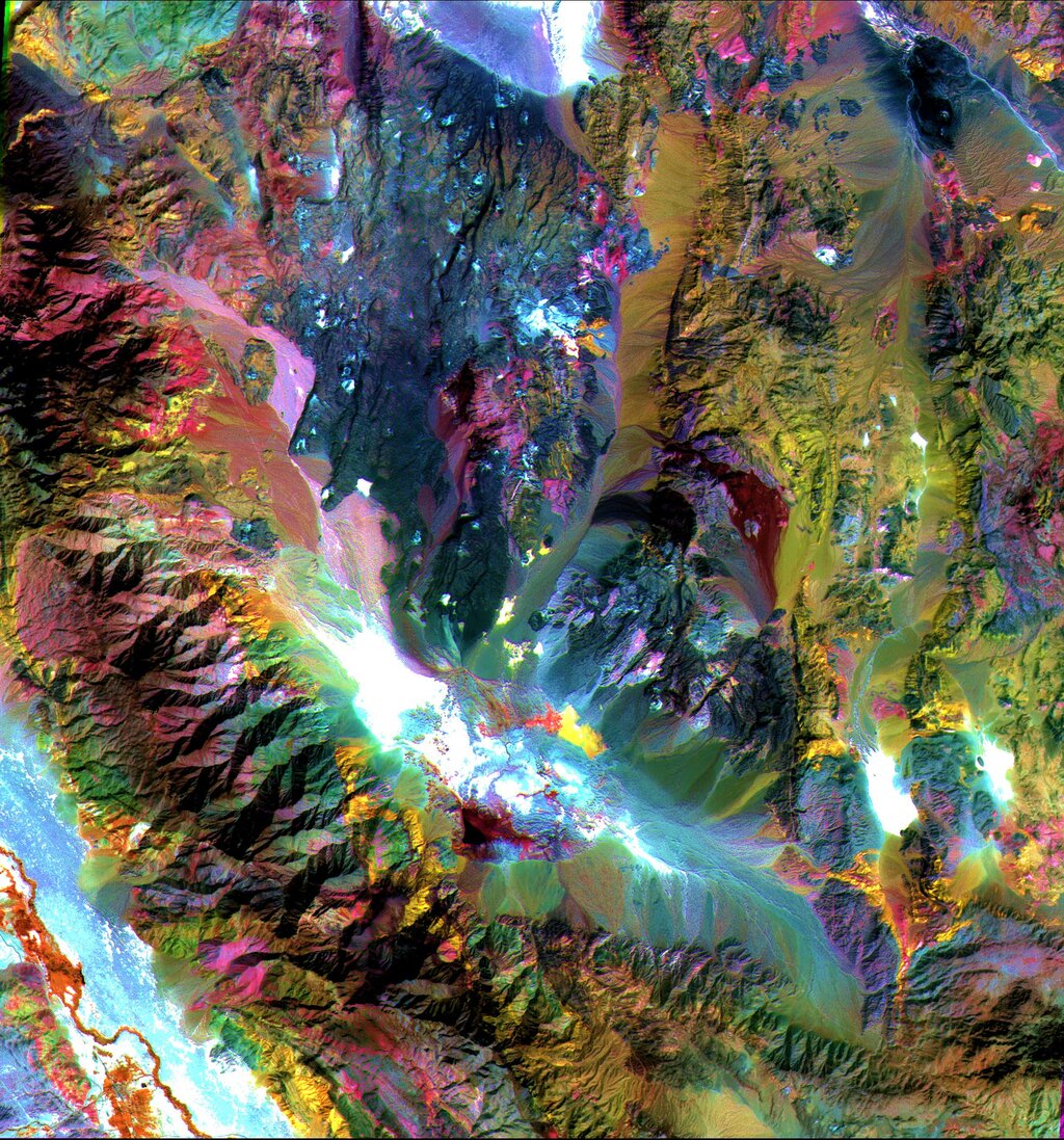
Image Quality and Resolution
Not all satellite images are created equal. The quality and type of information an image contains are defined by four types of resolution.
Spatial resolution refers to the level of detail. It's the size of the smallest object that can be seen in an image, often measured in meters per pixel. High spatial resolution means you can see smaller things, like individual cars, while low resolution might only show you an entire city block as a single dot.
Spectral resolution describes the sensor's ability to detect different wavelengths of light. A simple sensor might only capture red, green, and blue light, while a more advanced "hyperspectral" sensor can capture hundreds of very narrow bands, allowing it to identify specific minerals or types of vegetation.
Temporal resolution is how often a satellite revisits the same location. A satellite in geostationary orbit might view the same spot constantly, giving it very high temporal resolution, which is perfect for weather monitoring. A satellite in a lower orbit might only pass over the same spot once every few weeks.
Finally, radiometric resolution is the sensor's ability to distinguish between small differences in the intensity of reflected or emitted energy. Higher radiometric resolution means more subtle variations in brightness can be detected, which is useful for things like telling the difference between healthy and stressed plants.
| Resolution Type | What It Measures | Example |
|---|---|---|
| Spatial | Level of detail (pixel size) | Seeing a single house vs. an entire neighborhood. |
| Spectral | Number of color bands | A black-and-white photo vs. a full-color image. |
| Temporal | Frequency of revisits | A daily weather photo vs. a yearly map update. |
| Radiometric | Sensitivity to brightness | Distinguishing between 256 shades of gray vs. thousands. |
There's often a trade-off between these resolutions. A satellite with extremely high spatial resolution might have a lower temporal resolution because it takes longer to cover the entire globe.
Ready to check your understanding of these core concepts?
What was the name of the first successful weather satellite, launched by NASA in 1960?
A satellite sensor that relies on detecting the sun's reflected energy from Earth's surface is known as an active sensor.
These fundamental principles are the building blocks for understanding the vast world of Earth observation. From weather forecasting to resource management, the data from these eyes in the sky helps us understand and protect our changing planet.