Remote Sensing and GIS Fundamentals
Introduction to Remote Sensing
Seeing Without Touching
At its heart, remote sensing is the science of getting information about things from a distance. Your own eyes are a form of remote sensing. You can tell a tree is a tree without walking over and touching its bark. You're observing the light that reflects off of it.
In geography and Earth science, remote sensing works on the same principle, but on a much larger scale. Instead of just our eyes, we use sophisticated sensors mounted on satellites or aircraft to collect data about our planet. These sensors measure energy, usually in the form of electromagnetic radiation, that is reflected or emitted from Earth's surface.
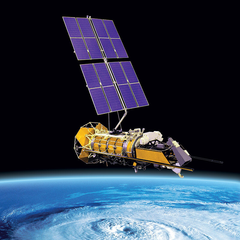
By analyzing this energy, scientists can monitor everything from deforestation in the Amazon and ice melt in the Arctic to crop health in the Midwest and urban growth in Asia. It's a powerful way to understand our world's complex systems.
The Spectrum of Light
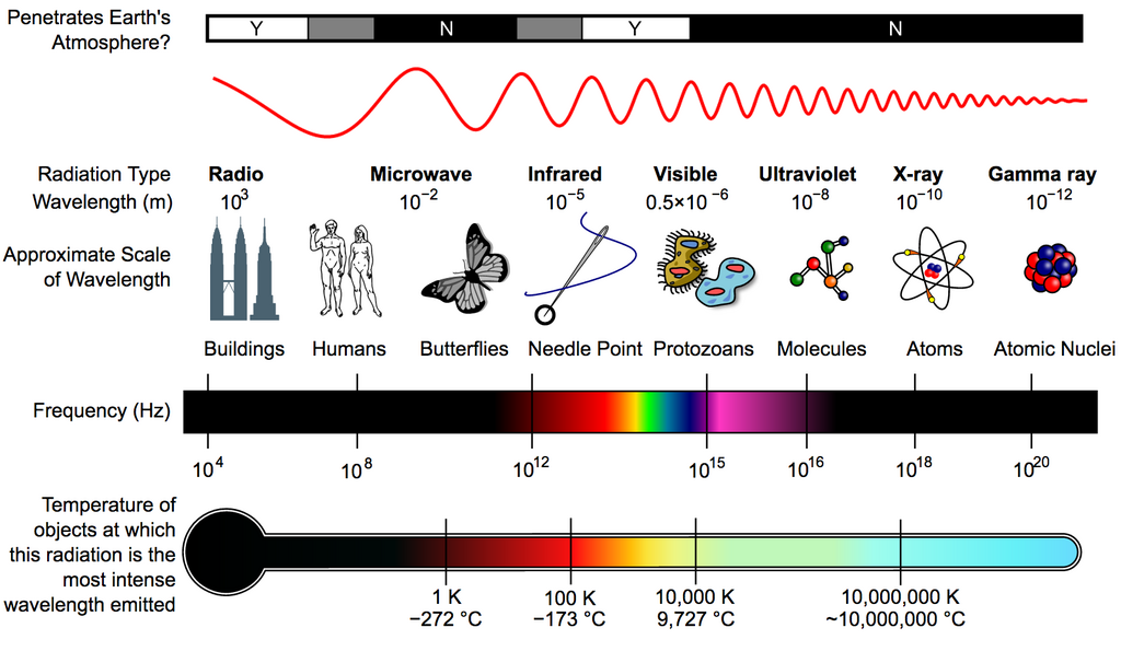
The visible light our eyes can see is just a tiny fraction of the energy that surrounds us. This energy travels in waves, and the full range of these waves is called the electromagnetic (EM) spectrum. It includes everything from high-energy gamma rays and X-rays with very short wavelengths to low-energy microwaves and radio waves with very long wavelengths.
Remote sensing instruments are designed to “see” in these different parts of the spectrum. This is crucial because different materials on Earth's surface interact with energy in unique ways. Water, soil, vegetation, and buildings all reflect and absorb different wavelengths. This unique pattern of interaction is known as a spectral signature.
Think of it like a fingerprint. Healthy green plants, for example, are great at absorbing red light (for photosynthesis) but strongly reflect near-infrared light, a wavelength our eyes can't see. By using a sensor that can detect near-infrared energy, we can easily map out vegetation and even assess its health from space.
Passive vs Active Sensing
Remote sensing systems can be categorized into two main types: passive and active.
Passive sensors detect naturally available energy. Most commonly, this is reflected sunlight. A standard digital camera is a passive sensor, as are many of the satellite instruments used for land cover mapping. They work like our eyes, capturing the energy that is already there. The downside is that they depend on the sun. They can't see through clouds and don't work at night.
Passive sensing is like reading a book by the light of a lamp. Active sensing is like reading in a dark room with a flashlight.
Active sensors provide their own source of energy to illuminate the target. They emit radiation and then measure the portion that is reflected or scattered back. Because they generate their own light, they can operate day or night and in any weather condition.
Two common types of active sensors are Radar and LiDAR.
-
Radar (Radio Detection and Ranging) sends out radio waves. It's excellent for measuring elevation, tracking storm systems, and seeing through clouds.
-
LiDAR (Light Detection and Ranging) uses pulses of laser light. It can create incredibly detailed 3D maps of the land surface and is often used for forestry and infrastructure mapping.
Let's check your understanding of these fundamental concepts.
What is the fundamental principle of remote sensing?
The unique pattern in which an object (like soil, water, or vegetation) reflects and absorbs different wavelengths of energy is known as its:
With these basics, you can start to see how powerful remote sensing is. By choosing the right platform, sensor, and part of the electromagnetic spectrum, we can learn almost anything about our planet from a distance.