Mastering Navigation Systems
Navigation Systems Overview
A World of Navigation
When we think of navigation today, our minds often jump straight to the blue dot on our smartphone map. That dot is powered by a Global Navigation Satellite System (GNSS), a network of satellites orbiting Earth, broadcasting signals that our devices can interpret. While satellite-based systems are dominant, they aren't the only way to find your way. An older, but still relevant, category of technology uses ground-based transmitters. Let's explore the main players in both categories.
Eyes in the Sky
Satellite navigation systems all work on a similar principle. A constellation of satellites orbits the Earth, each continuously broadcasting a signal containing its precise location and the time the signal was sent. A receiver on the ground, like your phone or a ship's navigation unit, picks up signals from multiple satellites. By calculating the time difference between when each signal was sent and when it was received, the receiver can determine its distance from each satellite. With data from at least four satellites, the receiver can pinpoint its exact location in three dimensions through a process called trilateration.
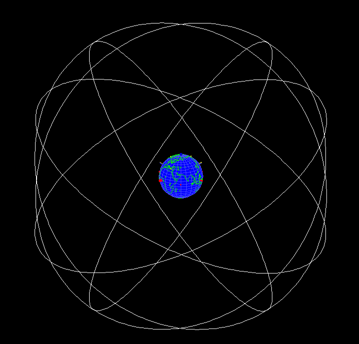
Several countries or unions operate their own GNSS, ensuring they have independent and reliable positioning capabilities. While they all serve a similar function, they have distinct characteristics.
| System | Operator | Global Coverage | Key Feature |
|---|---|---|---|
| GPS (Global Positioning System) | United States | Yes | The first and most widely used GNSS. |
| GLONASS (Global Navigation Satellite System) | Russia | Yes | Provides a crucial alternative and complement to GPS. |
| Galileo | European Union | Yes | Designed for civilian use, offering high accuracy. |
| BeiDou | China | Yes | Features a mix of satellites in different orbits for robust regional service. |
Signals from the Ground
Before satellites, navigation relied on terrestrial systems using ground-based radio transmitters. These systems use powerful, low-frequency radio waves that can travel long distances, following the curvature of the Earth. While less precise than modern GNSS, they offer a robust backup because their signals are harder to disrupt.
Two historical examples of this technology are LORAN and Decca.
LORAN (Long Range Navigation) works by measuring the time difference between the receipt of signals from a pair of radio towers. A receiver on a ship or aircraft uses this time difference to plot a line of position. By taking a measurement from a second pair of towers, it can plot a second line. The intersection of these two lines reveals the receiver's location. While largely phased out in favour of GPS, there's renewed interest in enhanced LORAN (eLORAN) as a resilient backup system for critical infrastructure.
Decca Navigator System was another hyperbolic radio navigation system that used phase comparison of continuous-wave signals from a chain of transmitters. It was highly accurate for its time but had a shorter range than LORAN. It was primarily used for coastal navigation and by fishing fleets in Europe before being decommissioned around the year 2000.
Choosing the Right System
The choice between a satellite or terrestrial system depends entirely on the application. For everyday use, like personal navigation and logistics, the global coverage and high precision of GNSS are unmatched. Most modern receivers can even use signals from multiple GNSS constellations simultaneously (like GPS and Galileo), improving accuracy and reliability.
However, GNSS has a key weakness: its signals are very faint. They can be easily blocked by buildings, dense forests, or tunnels, a phenomenon known as the 'urban canyon' effect. They are also vulnerable to intentional jamming and to disruption from solar flares.
This is where terrestrial systems have an advantage. Their low-frequency signals are much more powerful and less susceptible to these kinds of interference. For applications where navigation is absolutely critical, such as for large commercial ships or for timing signals in a nation's power grid, having a terrestrial system like eLORAN as a backup is a crucial safety measure. It ensures that if the satellite signals fail, there's another system ready to take over.
Satellite systems offer global precision, while terrestrial systems provide regional robustness.
Time to check your understanding of these navigation technologies.
What is the minimum number of satellites a GNSS receiver needs to connect with to accurately determine its location in three dimensions?
What is the primary reason that older, ground-based navigation systems like eLORAN are still considered valuable today?
Understanding the diversity of these systems reveals the different strategies developed to solve one of humanity's oldest challenges: knowing exactly where you are.