LiDAR for Surveying
Introduction to LiDAR
What Is LiDAR?
LiDAR stands for Light Detection and Ranging. At its core, it's a remote sensing method that uses light in the form of a pulsed laser to measure distances to the Earth. Think of it like a very advanced version of echolocation, the way bats navigate. A bat sends out a sound wave and listens for the echo. The time it takes for the echo to return tells the bat how far away an object is.
LiDAR does the same thing, but it uses rapid pulses of laser light instead of sound. It sends out a pulse, which travels to an object, reflects off it, and returns to the sensor. By measuring the time this round trip takes, a LiDAR system can calculate the distance to that object with incredible precision.
The fundamental principle is simple: Distance is calculated based on the time it takes for a laser pulse to travel to a target and back.
The Components of a System
A LiDAR system isn't just a laser. It's a sophisticated package of three critical components working together to create accurate 3D maps.
Laser Scanner
noun
The heart of the system. It emits thousands or even millions of laser pulses per second and detects their reflections. The scanner is mounted on a platform like an airplane, drone, or vehicle.
A Global Positioning System (GPS) receiver tracks the exact location of the LiDAR sensor in three-dimensional space (latitude, longitude, and altitude). Without knowing the sensor's precise position, the distance measurements would be meaningless.
An Inertial Measurement Unit (IMU) constantly measures the orientation of the sensor. Since the sensor is often moving, the IMU records its tilt and rotation (roll, pitch, and yaw). This ensures the system knows exactly which direction the laser was pointing for every single pulse it sends out.
Together, these three parts allow the system to calculate a precise 3D coordinate (X, Y, Z) for every point the laser pulse strikes.
Creating a 3D Model
The process of turning laser pulses into a 3D model is a rapid-fire calculation. For each pulse, the system:
- Records the time the pulse is sent.
- Records the time its reflection is received.
- Calculates the distance to the object using the time difference and the speed of light.
This calculation is based on a simple formula:
Here, is the constant speed of light. We divide by two because the measured time includes the journey to the target and back.
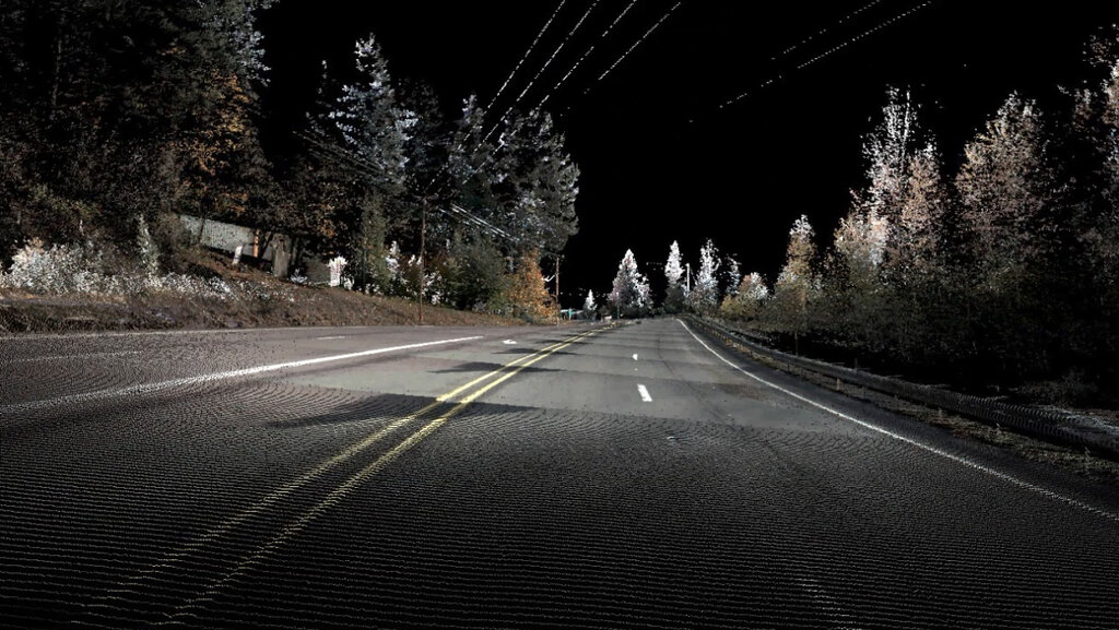
By combining this distance measurement with the sensor's known position from the GPS and its orientation from the IMU, the system determines the geographic coordinates of the reflection point. This process happens millions of times per second, generating a massive collection of individual data points. This dense collection of points is known as a point cloud, which forms the basis of the 3D model.
LiDAR's Edge in Surveying
Compared to traditional surveying methods, which involve taking measurements one point at a time, LiDAR is incredibly fast and efficient. A single flight can survey many square miles in a matter of hours, collecting data with a density that would be impossible to achieve on the ground.
One of LiDAR's most significant advantages is its ability to see through vegetation. While some laser pulses reflect off the top of a forest canopy, others find gaps in the leaves and branches to reach the forest floor.
This allows surveyors to create two distinct surfaces: a digital surface model (DSM) of the top of the canopy and a digital elevation model (DEM) of the bare ground beneath it. This is extremely difficult to do with other remote sensing methods like photography.
This capability is revolutionary for applications like forestry management, flood modeling, and archaeology, where understanding the true shape of the ground is critical. The high resolution and accuracy of LiDAR data provide a rich, detailed view of the landscape that was previously unimaginable.
Now that you have a grasp of the basics, let's test your understanding.
What is the fundamental principle behind how a LiDAR system measures distance?
In a LiDAR system, what is the specific function of the Inertial Measurement Unit (IMU)?
By combining light-speed measurements with precise location and orientation data, LiDAR gives us a powerful tool for mapping and understanding our world in three dimensions.