LiDAR Data Processing Essentials
Introduction to LiDAR
What Is LiDAR?
Imagine a bat flying in a dark cave. It sends out sound waves, and by listening to the echoes, it builds a mental map of its surroundings. LiDAR works on a similar principle, but instead of sound, it uses light. It's an active remote sensing method, meaning it sends out its own energy source—in this case, pulses of laser light.
LiDAR
noun
An acronym for Light Detection and Ranging, a remote sensing method that uses light in the form of a pulsed laser to measure ranges (variable distances) to the Earth.
The system measures how long it takes for each light pulse to hit an object and bounce back to the sensor. Since light travels at a constant and known speed, this “time of flight” can be used to calculate distance with incredible accuracy. By sending out millions of these pulses per second, a LiDAR system can create a dense, three-dimensional map of an area called a point cloud.
The Components of a System
While LiDAR systems can be complex, they are all built around a few core components working together. Each part plays a critical role in capturing the data needed to generate a 3D map.
| Component | Function |
|---|---|
| Laser | Emits rapid pulses of light, typically in the near-infrared spectrum. |
| Scanner | A mirror or prism that directs the laser pulses across the target area. |
| Receiver | A sensor that detects the light pulses that are reflected back. |
| GPS | Records the precise geographic location (latitude, longitude, altitude) of the sensor. |
| IMU | An Inertial Measurement Unit that measures the orientation (roll, pitch, yaw) of the sensor. |
The GPS and IMU are especially important. Without them, you'd just have a collection of distance measurements with no context. By combining the laser data with precise location and orientation information, the system can place every single data point in its correct 3D space, creating an accurate and usable model.
Types of LiDAR
LiDAR isn't a one-size-fits-all technology. Different systems are designed for different platforms and purposes.
Airborne LiDAR systems are mounted on aircraft, such as planes, helicopters, or drones. They are used to map large areas of land quickly and efficiently. This is ideal for projects like forestry management, flood plain mapping, and large-scale topographic surveys.
This method can capture details like the forest canopy and the ground beneath it by recording multiple returns from a single laser pulse. The first return might be the top of a tree, while the last return could be the forest floor.
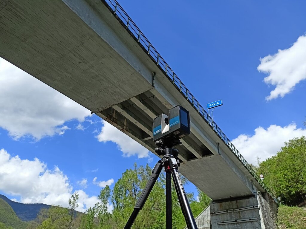
Terrestrial LiDAR systems are stationary, typically mounted on a tripod on the ground. They are used to capture highly detailed data of smaller areas, such as building facades, archaeological sites, or accident scenes. The scanner rotates to capture a full 360-degree view from its position.
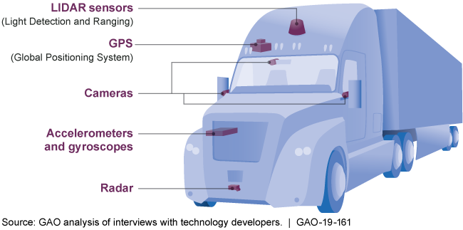
Finally, there's Mobile LiDAR. These systems are mounted on moving vehicles, like cars or trains. As the vehicle moves, the sensor scans the surrounding environment. This is the technology that allows autonomous vehicles to “see” the world around them, identifying other cars, pedestrians, and road signs in real time. It's also used for mapping road networks and infrastructure with high precision.
Real-World Applications
Because of its versatility, LiDAR has found uses in dozens of fields. In forestry, it helps measure forest density and biomass. Urban planners use it to create detailed 3D city models for development and solar panel placement analysis. Archaeologists can uncover hidden ruins and ancient landscapes that are invisible to the naked eye, covered by centuries of vegetation.
In agriculture, it helps farmers optimize crop yields by creating precise elevation maps for irrigation. And in the energy sector, LiDAR is used to survey power lines to identify vegetation that might cause an outage. Its ability to capture the world in three dimensions with stunning accuracy has made it an indispensable tool for science, industry, and exploration.
Ready to check your understanding of these core concepts?