Introduction to Coordinate Systems
Introduction to Coordinate Systems
A Map for Numbers
How do you describe where something is? You might say, "It's five blocks north and two blocks east." Or, "It's on the third floor, second door on the left." In both cases, you're using a system to pinpoint a location. A coordinate system does the same thing, but for math. It's a framework that uses numbers, or coordinates, to uniquely determine the position of a point in space.
Coordinate
noun
A set of values that show an exact position.
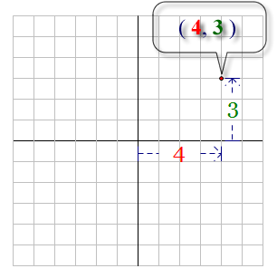
Think of it as a grid laid over a space. By specifying a position along each axis of the grid, you can land on any exact spot. This simple idea is incredibly powerful because it turns geometry—the study of shapes—into algebra, the study of numbers and equations. Suddenly, we can describe a circle or a parabola using an equation instead of just drawing it.
From Geometry to Algebra
For centuries, geometry and algebra were treated as separate branches of mathematics. Geometry dealt with shapes, lines, and angles, while algebra focused on equations. That changed in the 17th century with the work of French philosopher and mathematician René Descartes. Legend has it that Descartes, while lying in bed, watched a fly buzzing around on the ceiling. He realized he could describe the fly's path by tracking its distance from two perpendicular walls.
This insight led to the development of the Cartesian coordinate system, named in his honor. It was a revolutionary idea that bridged the gap between two worlds. By placing geometric shapes onto a coordinate grid, mathematicians could analyze them with the precision of algebraic equations. This connection, now called analytic geometry, became a cornerstone of modern science and engineering.
Coordinate systems give us a language to translate visual shapes into numerical equations, and vice versa.
Different Kinds of Maps
Just as there are different types of maps for different purposes—road maps, topographic maps, political maps—there are different types of coordinate systems. The best one to use depends on the problem you're trying to solve.
Cartesian Coordinates: This is the familiar grid with a horizontal x-axis and a vertical y-axis. It's perfect for describing squares, lines, and other shapes with straight edges. A point is defined by its distance along the x-axis and its distance along the y-axis, like .
Polar Coordinates: Instead of using two distances, this system uses a distance and an angle. Imagine standing at a central point. To find any other point, you just need to know which direction to face (the angle) and how far to walk (the distance). This system, written as , is especially useful for describing things that move in circles or spirals, like planets orbiting the sun.
Homogeneous Coordinates: This is a more abstract system often used in computer graphics. It adds an extra number, or dimension, to a point's coordinates. This trick makes it easier for computers to perform calculations related to 3D perspective, like making objects appear smaller as they move farther away. It elegantly handles concepts like points at infinity, which are tricky in other systems.
Putting Coordinates to Work
Coordinate systems are everywhere, even if we don't see them. They are the silent engine behind many modern technologies.
- Geography and Navigation: GPS devices use a coordinate system (latitude and longitude) to determine your exact location on Earth.
- Computer Graphics: Every character in a video game and every object in a 3D movie has its position defined by coordinates. Animators move and transform these objects by changing their coordinate values.
- Physics and Engineering: Scientists use coordinate systems to model everything from the flight path of a rocket to the forces acting on a bridge.
- Data Visualization: When you see a bar chart or a scatter plot, you're looking at data points plotted on a Cartesian coordinate system. This visual representation helps us understand trends and relationships in data.
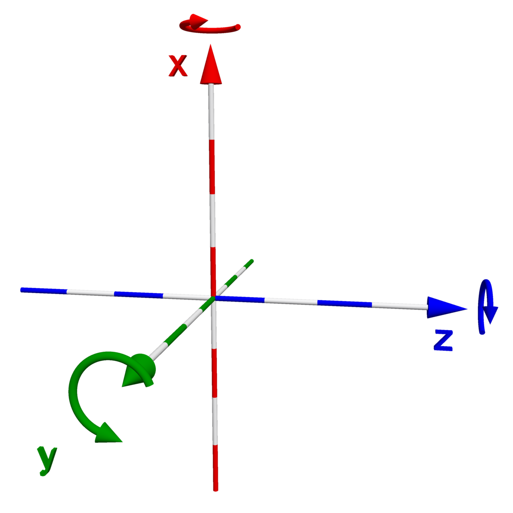
By providing a universal language to describe location and shape, coordinate systems give us the power to model our world, solve complex problems, and create new virtual realities.
What is the primary purpose of a coordinate system?
The development of the Cartesian coordinate system was a revolutionary step because it connected which two, previously separate, branches of mathematics?