Introduction to China
Geography
A Land of Contrasts
China's geography is a study in extremes. Its sheer size, comparable to the United States, contains nearly every type of landscape imaginable. You can find windswept deserts, tropical coastlines, towering mountain ranges, and fertile plains all within its borders. This immense variety has profoundly shaped where people live, what they grow, and how they travel.
The simplest way to understand China's terrain is to think of it as a giant, three-step staircase descending from west to east. This topographical layout dictates the flow of its major rivers and influences its climate, creating distinct regions across the country.
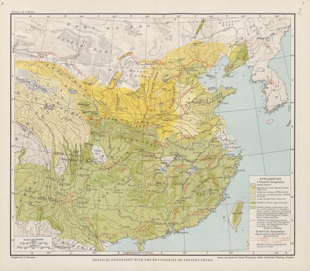
The Three Great Steps
The highest step, in the west, is the Tibetan Plateau. Often called the "Roof of the World," it's a vast, high-altitude region averaging over 4,500 meters (14,800 feet) above sea level. This is where you'll find the Himalayas, the world's tallest mountain range. The air is thin, and the climate is harsh, making it one of the most sparsely populated areas on Earth.
Stepping down to the east, we reach the middle-altitude basins and plateaus. This second step includes the Loess Plateau, a region covered in fine, wind-blown silt, and the rugged Yunnan-Guizhou Plateau. These areas are characterized by smaller mountain ranges, large basins like the Sichuan Basin, and deserts such as the Gobi and Taklamakan in the north.
The final and lowest step is the eastern coastal region. This area is dominated by low-lying plains and river deltas, most notably the North China Plain and the Yangtze River Delta. These plains are incredibly fertile and crisscrossed by rivers, making them the agricultural heartland of the country and home to the majority of China's population.
Two Mighty Rivers
Two major rivers begin on the high Tibetan Plateau and flow eastward, carrying water and sediment across the country. They have acted as the cradles of Chinese civilization.
The Yellow River, or Huang He, gets its name from the enormous amount of yellowish silt, called loess, that it carries from the Loess Plateau. This silt makes the surrounding land extremely fertile. However, the same sediment also raises the riverbed, making the Yellow River prone to catastrophic floods. This dual nature earned it the nickname "China's Sorrow."
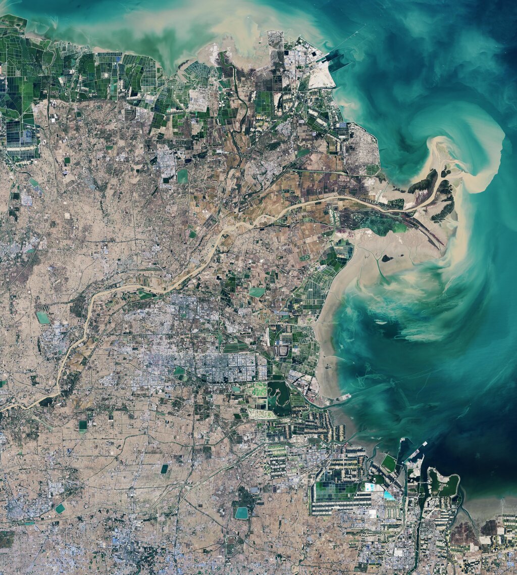
Further south is the Yangtze River, or Chang Jiang, the longest river in Asia. It's a vital artery for transportation, linking the coast with the interior. Its vast basin is warmer and wetter than the Yellow River's, making it ideal for rice cultivation. The famous Three Gorges Dam, one of the world's largest power stations, is located on the Yangtze.
Climate and People
China's massive size and complex topography create a wide array of climates. The north experiences cold, dry winters and hot summers, while the south is subtropical, with hot, humid summers and mild winters influenced by monsoon rains. The northwest is dominated by arid desert conditions, and the high-altitude Tibetan Plateau has a cold, tundra-like climate year-round.
| Region | Dominant Climate | Key Characteristics |
|---|---|---|
| Northeast | Humid Continental | Cold, dry winters; warm, short summers |
| Northwest | Arid / Desert | Large temperature swings; very little rainfall |
| East / Southeast | Humid Subtropical | Hot, rainy summers; mild, damp winters |
| Southwest (Plateau) | Alpine / Tundra | Cold and dry all year due to high altitude |
This geographical and climatic diversity directly impacts where people live and what they farm. The vast majority of China's population lives in the eastern half of the country, on the fertile plains nourished by the great rivers. This region, often called "China Proper," has reliable rainfall and a favorable climate for intensive agriculture.
Population follows the water. The eastern river plains support hundreds of millions of people, while the arid and mountainous west remains sparsely inhabited.
Agriculture adapts to these regional differences. In the warmer, wetter south, rice paddies are a common sight, often carved into hillsides in stunning terraces. In the drier, colder north, farmers primarily cultivate wheat, millet, and soybeans. In the vast grasslands of the west, nomadic herding of sheep, goats, and yaks has been a way of life for centuries.
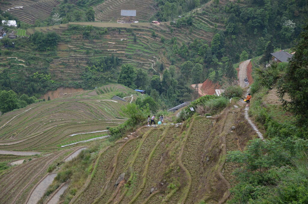
So from the icy peaks of the Himalayas to the bustling river deltas, China's landscape is not just a backdrop. It's the foundation upon which its culture, population patterns, and ways of life are built.
Ready to test your knowledge?
The vast majority of China's population lives in the eastern half of the country. What is the primary geographical reason for this settlement pattern?
The Yellow River (Huang He) gets its name from the yellowish silt, or loess, it carries. This loess has what dual effect on the region?
Understanding these geographic fundamentals is key to appreciating the complexities of China's long history and dynamic present.