Indian River Systems Analysis
Himalayan Drainage Systems
Rivers Older Than Mountains
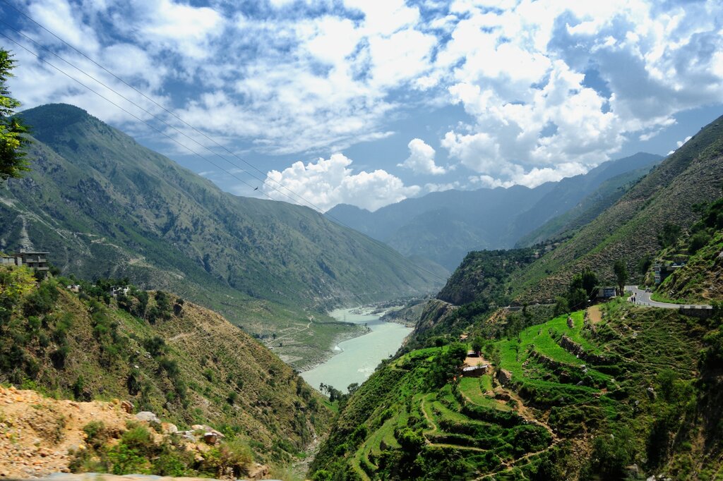
The great rivers of the Himalayas did not arise from the mountains; rather, the mountains rose around them. The Indus, Brahmaputra, and Sutlej are examples of antecedent drainage, meaning they existed before the Himalayan uplift began. As the Indian and Eurasian tectonic plates collided and the mountains began their slow, colossal ascent, these powerful rivers maintained their courses, carving out immense gorges that are among the deepest in the world. They are, in a very real sense, older than the peaks they now flow between.
The Indus and Its Five Rivers
Originating near Lake Mansarovar in Tibet, the Indus River flows west, carving a long path through the high-altitude desert of Ladakh before making a sharp southward turn into Pakistan. Its system is defined by five major eastern tributaries that give the Punjab region its name—the “land of five rivers.” These rivers, known collectively as the Panjnad before they merge with the Indus, create a vast and fertile plain.
| River | Origin Area | Key Feature |
|---|---|---|
| Jhelum | Verinag Spring (Kashmir) | Flows through the city of Srinagar and Wular Lake. |
| Chenab | Baralacha La Pass (Lahaul) | The largest of the five tributaries by volume. |
| Ravi | Rohtang Pass (Kullu) | Flows through the historic Chamba valley. |
| Beas | Rohtang Pass (Kullu) | The only one of the five to flow entirely within India. |
| Sutlej | Lake Rakshastal (Tibet) | An antecedent river that carved its own gorge. |
This river network was the cradle of the ancient and remains the agricultural lifeblood of Pakistan and northern India. The distribution of these waters is a matter of intense geopolitical importance, governed by the of 1960. The treaty allocated the waters of the three western rivers (Indus, Jhelum, Chenab) to Pakistan and the three eastern rivers (Ravi, Beas, Sutlej) to India, a framework that has largely held despite regional conflicts.
The Ganga-Brahmaputra-Meghna System
Further east, two colossal river systems, the Ganga and the Brahmaputra, combine to form the world's largest delta before emptying into the Bay of Bengal. The Ganga, rising as the Bhagirathi from the Gangotri glacier, flows across the vast plains of northern India, collecting numerous tributaries. Its drainage pattern is classically dendritic, resembling the branching structure of a tree as smaller streams feed into larger ones.
Dendritic drainage patterns typically develop on land with a uniform and gentle slope, where the underlying geology doesn't steer the water's flow in any particular direction.
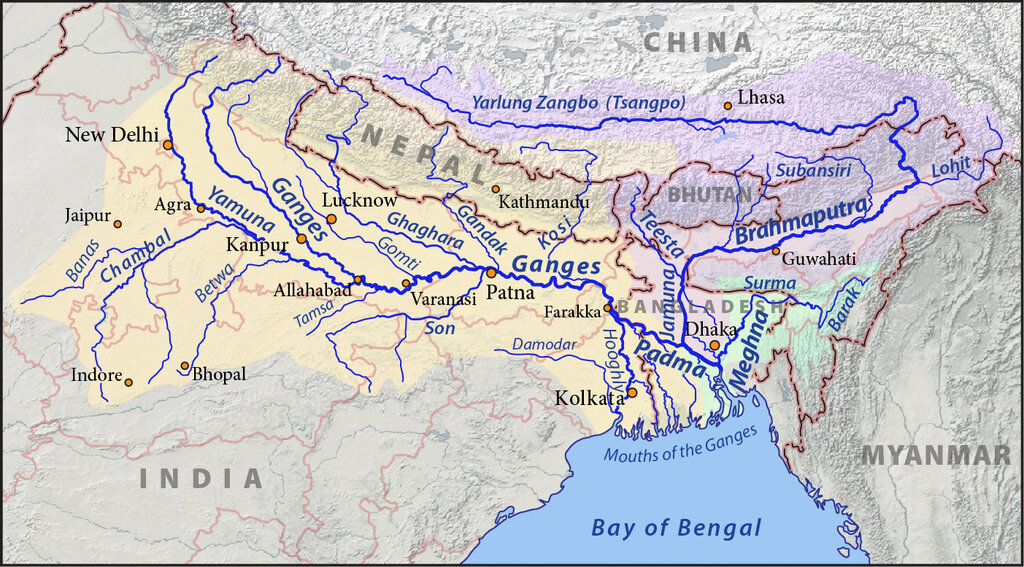
The Brahmaputra, known as the Yarlung Tsangpo in Tibet, takes a much different route. It flows east across the Tibetan plateau before making a dramatic U-turn at the Namcha Barwa peak, entering India through Arunachal Pradesh. In the Assam valley, its channel becomes braided, splitting into a shifting network of smaller channels separated by temporary islands of sediment. Finally, in Bangladesh, it joins the Ganga (called the Padma there), and later the Meghna, to form the massive GBM basin.
Monsoon and Meltwater
Himalayan rivers are perennial, but their flow is not uniform throughout the year. Their hydrological regime is a tale of two sources: glacial melt and monsoon rains. From spring into early summer, as temperatures rise, the Himalayan glaciers and snowfields begin to melt, feeding a steady flow of water into the rivers. This provides a reliable base flow that sustains the rivers before the monsoon arrives.
Then comes the Indian Monsoon. From June to September, intense rainfall drenches the Himalayan foothills and the Indo-Gangetic plain. This precipitation causes a dramatic surge in river discharge, leading to peak flows and widespread flooding. This dual-source system—glacial melt providing a consistent supply and the monsoon delivering a massive seasonal pulse—is unique to the Himalayan rivers. However, it also creates immense challenges, as the enormous volume of water and the high sediment load it carries cause rivers to frequently shift their courses, a process known as meandering. The Kosi River, a tributary of the Ganga, is infamous for this, having shifted its course over 120 kilometers in the last 250 years, earning it the name "Sorrow of Bihar."
The Indus, Brahmaputra, and Sutlej rivers are considered older than the Himalayas because they maintained their flow as the mountains rose. What is the geological term for this type of river system?
Under the 1960 Indus Waters Treaty, which group of rivers was allocated for use primarily by India?