Immigration and the Shifting Sands of Borders
Introduction to National Borders
Lines on a Map
A national border is more than just a line on a map. It’s a dividing line that marks the edge of a country's territory. Within that line, a nation's government has authority, or sovereignty, over the land and its people. This means it can make laws, collect taxes, and control who enters and leaves.
Sovereignty
noun
The supreme authority within a territory. It signifies a government's independence and its right to govern without external interference.
Borders define where one country ends and another begins. They shape a sense of national identity, creating a distinction between 'us' and 'them'. But these lines are not permanent fixtures of the natural world. They are human creations, and their stories are often complex and turbulent.
Borders are not neutral lines on a map but socio-political constructions laden with power, identity, and contested meanings.
From Frontiers to Fences
For much of human history, clear, fixed borders didn't exist. Ancient empires had frontiers, which were often blurry, shifting zones of influence rather than sharp lines. A river or a mountain range might serve as a rough boundary, but control often faded gradually the farther one moved from the empire's center.
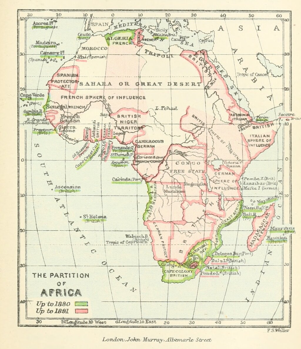
The idea of the modern nation-state, with precisely defined and defended borders, is relatively new. A major turning point was the Peace of Westphalia in 1648. This series of treaties ended major conflicts in Europe and established the principle of state sovereignty. For the first time, the idea that a state had exclusive control over its defined territory became a cornerstone of international relations.
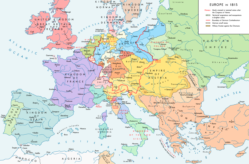
The age of colonialism spread this European model of border-making across the globe. Colonial powers drew lines on maps in Africa, Asia, and the Middle East with little regard for the ethnic, linguistic, or religious groups living there. These artificial borders often split communities or forced rival groups into a single state, creating tensions that continue to this day.
What Shapes a Border?
National borders are the result of many forces, from the physical landscape to the outcomes of wars. Understanding these factors helps explain why borders are where they are.
| Factor | Description | Example |
|---|---|---|
| Natural Features | Borders often follow geographical barriers like rivers, mountains, or oceans. | The Rio Grande forms a large part of the border between the U.S. and Mexico. |
| Political Agreements | Treaties signed after wars or negotiations can create, abolish, or redraw borders. | The Treaty of Versailles after World War I created several new countries and borders in Europe. |
| Cultural Lines | Sometimes, borders are drawn to separate different ethnic, linguistic, or religious groups. | The partition of India in 1947 created Pakistan as a separate nation for Muslims. |
| Historical Lines | Many borders are based on old administrative divisions from former empires or kingdoms. | Many borders between states in the U.S. originated as colonial charters. |
Most borders are a combination of these factors. They are a snapshot of a moment in history, reflecting the power dynamics, geographic realities, and political decisions of their time.
A Nation on the Move
Few countries illustrate the fluid nature of borders better than Poland. Its location in Central Europe has made it a crossroads for armies and empires, and its map has been redrawn countless times.
In the late 18th century, Poland was a large state. But powerful neighbors—Russia, Prussia, and Austria—carved it up in a series of agreements called the Partitions. By 1795, Poland had completely vanished from the map of Europe, its territory absorbed by its neighbors.
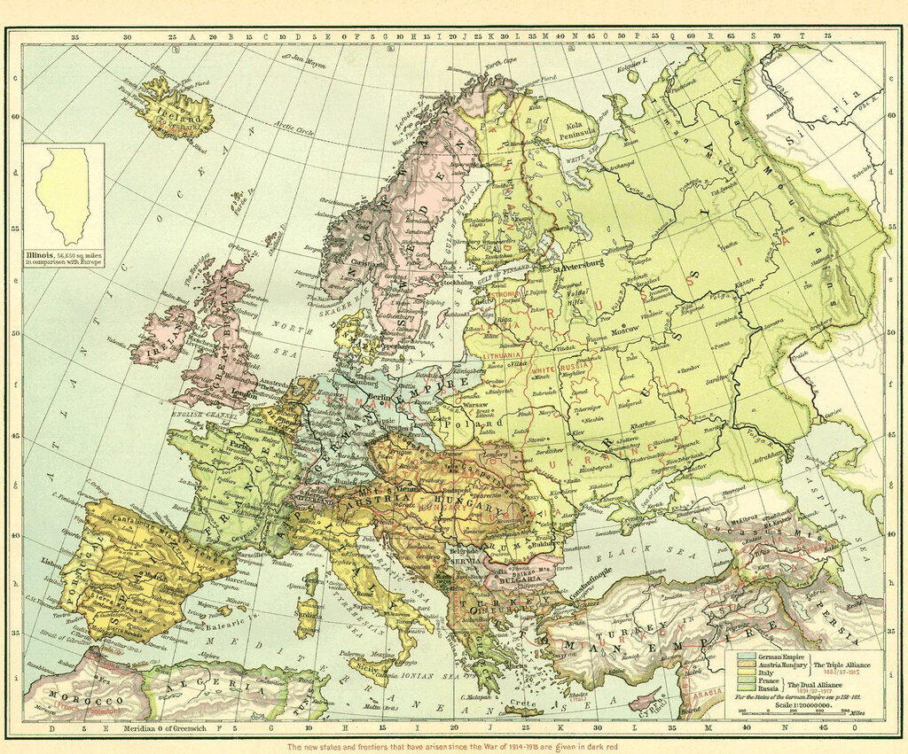
Poland did not exist as an independent state for 123 years. It was reborn after World War I in 1918, but its troubles were far from over. The country's borders were a point of contention and conflict. Following World War II, Poland's borders were shifted dramatically westward by the Allied powers. The country lost significant territory in the east to the Soviet Union but gained former German lands in the west.
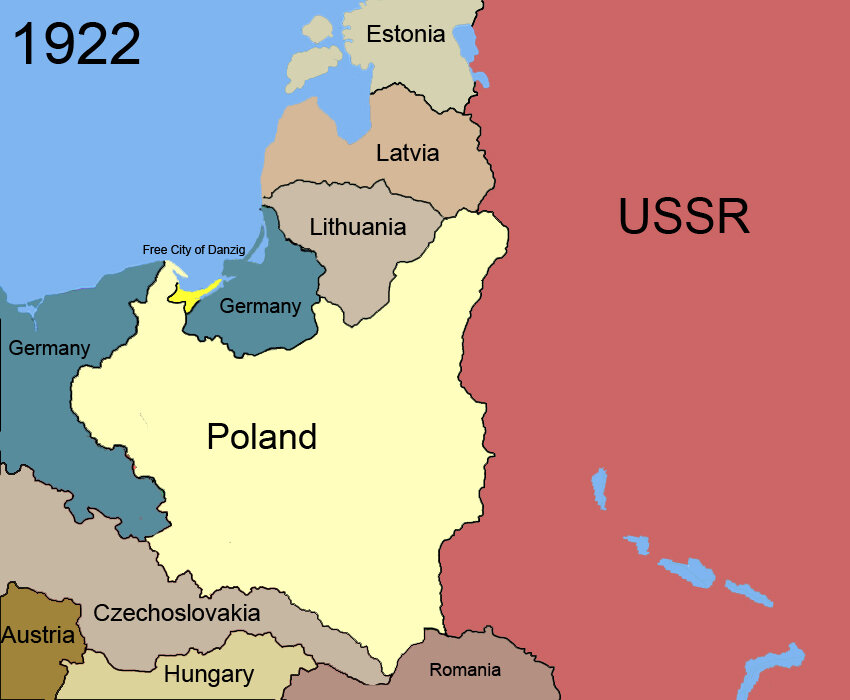
The story of Poland's borders is a powerful reminder that these lines are not fixed. They are constantly negotiated and contested, shaped by the forces of history, politics, and power. They define nations, but they also reflect a world in constant change.