Geopolitics and Intercultural Management in Africa
Introduction to Geopolitics
What is Geopolitics?
At its heart, geopolitics is the study of how geography shapes politics and international relations. It's about the connections between a country's location, its physical features, its climate, and its power on the world stage. Think of the world as a giant chessboard. Geopolitics helps us understand the board itself—the mountains, oceans, and rivers that influence how the pieces can move.
Geopolitics refers to the study or analysis of the influence of geography (physical features, location, resources, etc.) on political decisions, international relations, and global power dynamics.
This isn't just about drawing lines on a map. It's about recognizing that a country with vast, fertile plains might become a breadbasket for the world, giving it economic leverage. A nation controlling a narrow strait of water can influence global trade. And a state surrounded by mountains has a natural defense that a country on an open plain lacks. These physical realities have always guided the decisions of leaders and the destinies of nations.
geopolitics
noun
The study of how geography influences politics and the relations between countries.
A Brief History of an Idea
While leaders have intuitively understood the link between land and power for millennia, geopolitics as a formal field of study emerged in the late 19th and early 20th centuries. Thinkers at the time were trying to create a science of statecraft, looking for universal laws that could explain the rise and fall of empires.
One of the most influential early figures was Halford Mackinder, a British geographer. In 1904, he proposed a groundbreaking idea that would shape foreign policy for decades. He looked at the world map and saw a massive, resource-rich landmass he called the "World-Island," consisting of Europe, Asia, and Africa. At its center was the "Heartland."
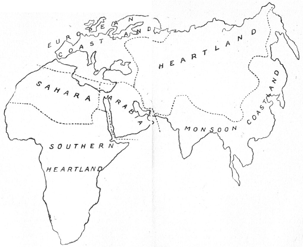
Mackinder argued that whoever controlled this Heartland—a vast area roughly corresponding to Eastern Europe and Russia—could command the entire World-Island, and consequently, the world. His theory suggested that land-based power could ultimately overshadow sea-based power, a radical idea at a time when the British Empire ruled the waves. This kind of thinking, known as classical geopolitics, often viewed states as organisms competing for space and resources.
Key Geopolitical Theories
Mackinder's Heartland Theory was just the beginning. It sparked a debate that produced several competing ideas about how geography shapes global power.
Heartland Theory: He who rules East Europe commands the Heartland; who rules the Heartland commands the World-Island; who rules the World-Island commands the world.
In response, Dutch-American strategist Nicholas Spykman developed the Rimland Theory. He agreed that the World-Island was key, but argued that the real power lay in the coastal areas, or the "Rimland," that surrounded the Heartland. This ring of coastal lands—including Western Europe, the Middle East, and South and East Asia—was more populous, had more resources, and had access to sea lanes. Spykman famously countered Mackinder by saying, "Who controls the Rimland rules Eurasia; who rules Eurasia controls the destinies of the world."
These classic theories treated geography as a fixed determinant of a country's fate. More modern approaches, often called critical geopolitics, take a different view. They argue that geopolitical ideas aren't just objective truths; they are also stories and arguments used by politicians and media to justify certain actions, like going to war or forming alliances.
How Geography Shapes Power
Theories aside, the practical influence of geography on political power is undeniable. It happens in several key ways.
| Geographic Factor | Influence on Political Power |
|---|---|
| Natural Resources | Access to oil, gas, minerals, or water can create wealth and international leverage. |
| Topography | Mountains and deserts can act as natural defenses, while rivers can facilitate trade and transport. |
| Climate | Favorable climates support agriculture and large populations, forming a strong foundation for a state. |
| Location | Proximity to strategic trade routes or chokepoints can give a nation immense influence over global commerce. |
Consider global shipping lanes. A huge portion of the world's trade passes through a few narrow maritime channels, like the Strait of Malacca, the Suez Canal, and the Panama Canal. The countries that control or are situated near these chokepoints hold a position of incredible strategic importance. Their geography gives them a direct say in the flow of the global economy.
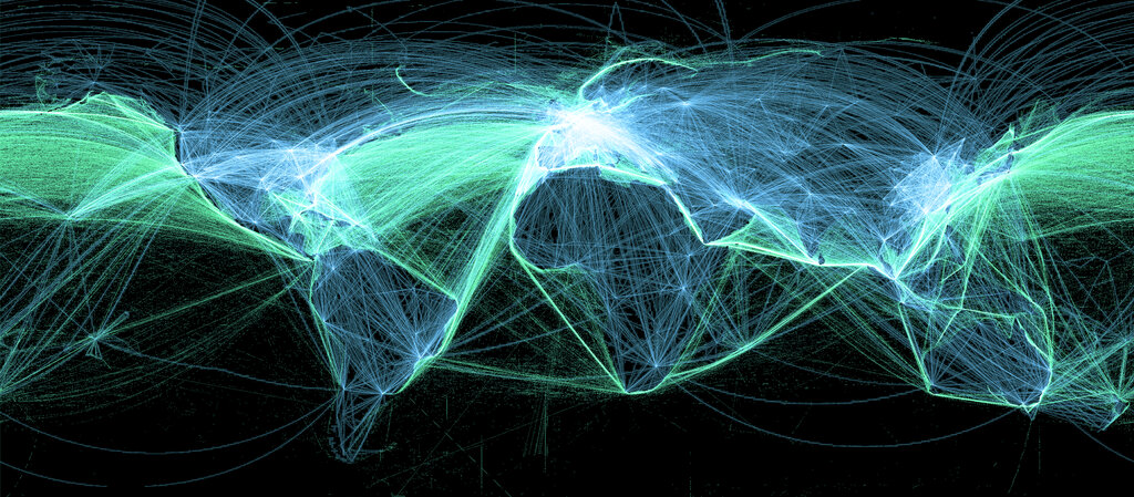
Similarly, access to a warm-water port—one that doesn't freeze in winter—has been a major driver of foreign policy for countries like Russia for centuries. Without it, a nation's navy and commercial fleet can be trapped for months, limiting its economic and military reach. These are not abstract theories; they are hard geographical facts that shape the ambitions and limitations of nations.
Time to review what we've covered.
Let's test your understanding with a few questions.
What is the central focus of geopolitics?
According to Halford Mackinder's Heartland Theory, which area was considered the key to controlling the 'World-Island' and, consequently, the world?
By understanding these core concepts, you have a new lens through which to view world events. The next time you read a headline about a territorial dispute or a new trade agreement, think about the map. The geography behind the story is often as important as the politics.