Exploring Asia's Geography
Introduction to Asia
Defining a Continent
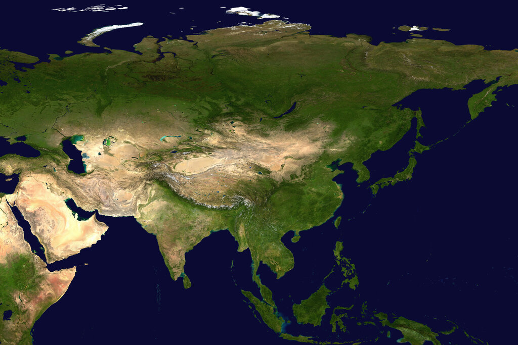
Asia is the world's largest and most populous continent, but its borders aren't as clear-cut as you might think. Geographically, Asia and Europe are part of a single, massive landmass called Eurasia. The boundary between them is more of a historical and cultural convention than a strict geographical line.
Traditionally, this dividing line runs along the Ural Mountains in Russia, down to the Caspian Sea, and then through the Caucasus Mountains to the Black Sea. To the southwest, the Suez Canal in Egypt separates Asia from Africa. Everything east of this line, stretching all the way to the Pacific Ocean, is considered Asia.
A Land of Extremes
Asia's geography is a study in contrasts. It's home to both the highest point on Earth, Mount Everest, and the lowest, the Dead Sea. This incredible diversity is shaped by its massive mountain ranges, sprawling plains, and powerful rivers.
The Himalayas, the world's tallest mountain range, arc across the southern edge of the Tibetan Plateau. This plateau, often called the "Roof of the World," is so high and vast that it dramatically influences weather patterns across the entire continent.
Flowing from these highlands are some of the world's most important rivers. The Yangtze and Yellow Rivers in China, and the Ganges and Indus Rivers in South Asia, have supported civilizations for thousands of years, providing water for drinking and agriculture to billions of people. Away from the mountains and rivers, you'll find enormous plains like the West Siberian Plain and vast, arid deserts like the Gobi and the Arabian Desert.
From icy tundra in the north to tropical rainforests in the south, Asia's landscapes are incredibly varied.
Climate and Regions
Given its size, it's no surprise that Asia has every type of climate. The far north, in Siberia, is an Arctic tundra. Further south, you find vast continental climates with hot summers and cold winters. Tropical climates, with heavy monsoon rains and dense rainforests, dominate Southeast Asia and parts of South Asia. Much of the Middle East and Central Asia is characterized by dry, desert climates.
To make sense of this diversity, geographers often divide Asia into several major subregions. While the exact boundaries can vary, they are generally grouped by shared cultural, political, or geographical features.
- East Asia: Includes China, Japan, and the Korean Peninsula. It is defined by major river valleys and coastal plains.
- South Asia: Consists of the Indian subcontinent and surrounding countries. It is geographically dominated by the Himalayan mountains and the vast Indo-Gangetic Plain.
- Southeast Asia: A region of peninsulas and thousands of islands, including countries like Vietnam, Indonesia, and the Philippines. It has a largely tropical climate.
- Central Asia: The heart of the continent, this region is made up of vast grasslands (steppes) and deserts. It includes countries like Kazakhstan and Uzbekistan.
- The Middle East (West Asia): This arid region connects Asia to Africa and Europe. It is mostly desert but contains fertile river valleys like Mesopotamia.
What is traditionally considered the main geographical feature forming part of the dividing line between Europe and Asia?
The massive landmass that includes both Asia and Europe is known as __________.
This geographical overview provides a foundation for understanding the diverse cultures, histories, and environments across this vast continent.