Discovering Colombia A Comprehensive Guide
Geography
A Country of Six Regions
Colombia's geography is defined by its incredible diversity. The country isn't just one landscape, but a collection of six distinct natural regions, each with its own climate, terrain, and culture. This variety is largely thanks to the massive Andes mountain range, which splits into three separate chains, or cordilleras, as it runs through the country.
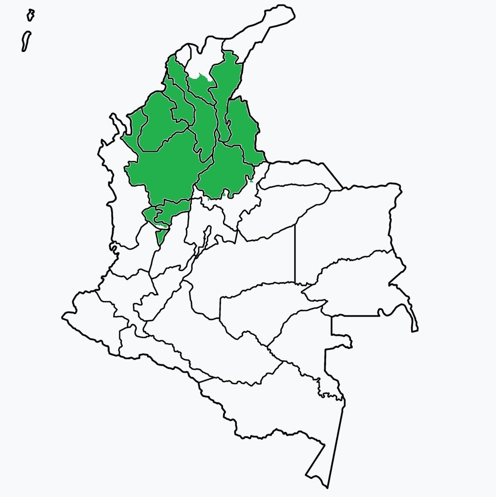
Let's explore these six regions:
-
Andean Region: This is the most populous part of Colombia. The three Andean cordilleras (Western, Central, and Eastern) create a landscape of towering peaks, fertile valleys, and high plateaus. Major cities like Bogotá, Medellín, and Cali are located here. The mountains are the source of most of Colombia's rivers.
-
Caribbean Region: Along the northern coast, this region is characterized by hot, humid lowlands. It's home to beautiful beaches, coastal plains, and the Sierra Nevada de Santa Marta, a unique mountain range that rises dramatically from the sea.
-
Pacific Region: This region on the western coast is one of the wettest places on Earth. It's covered in dense tropical rainforests and mangrove swamps and is defined by its incredible biodiversity. It's also a region with a strong Afro-Colombian cultural presence.
-
Orinoquía Region (Eastern Plains): Also known as the Llanos Orientales, this is a vast tropical grassland plain east of the Andes. The region is characterized by its extensive savannas and is crucial for cattle ranching and agriculture.
-
Amazon Region: In the south, Colombia shares a large portion of the Amazon rainforest. This sparsely populated area is a world of immense biodiversity, with dense jungles and winding rivers. It is home to many indigenous communities.
-
Insular Region: This includes Colombia's islands in both the Caribbean Sea (like the San Andrés and Providencia archipelago) and the Pacific Ocean (like Malpelo and Gorgona islands).
The Andes Mountains act as a spine, influencing everything from where people live to the types of crops they can grow.
Climate and Altitude
In a tropical country like Colombia, temperature isn't determined by the season but by altitude. As you go higher into the mountains, the climate gets cooler. This creates distinct thermal zones, each with its own characteristic vegetation and agriculture.
This vertical climate system means that Colombia can produce a huge variety of foods, from tropical fruits in the tierra caliente (hot land) to potatoes in the tierra fría (cold land), and world-renowned coffee in the perfectly balanced tierra templada (temperate land).
A Wealth of Natural Resources
Colombia's complex geology has blessed it with a vast array of natural resources. These resources are crucial to its economy, though their extraction also presents environmental challenges, particularly in sensitive areas like the Amazon.
| Resource Category | Key Examples |
|---|---|
| Fossil Fuels | Petroleum, Natural Gas, Coal |
| Metals | Iron Ore, Nickel, Gold, Copper |
| Gemstones | Emeralds (world's leading producer) |
| Energy | Hydropower (from its many rivers) |
The country is the world's leading producer of high-quality emeralds. Its abundant rivers, flowing down from the Andes, also provide a significant source of renewable energy through hydropower.
Which mountain range is the primary geographical feature that splits into three separate chains, or 'cordilleras', defining much of Colombia's landscape and climate?
A Colombian farmer wants to cultivate crops that thrive in a temperate, well-balanced climate, such as high-quality coffee. In which thermal zone should they establish their farm?
Understanding this geographical foundation is key to understanding Colombia itself.