Atmospheric Dynamics and Forecasting
Atmospheric Thermodynamics
The Engine of Weather
The atmosphere is a massive heat engine, constantly converting thermal energy into motion. To understand this engine, meteorologists simplify things by focusing on a hypothetical chunk of the atmosphere called an air parcel—a small, insulated blob of air that doesn't mix with its surroundings. The behavior of this parcel is governed by the First Law of Thermodynamics, which is a statement of energy conservation.
For an ideal gas, the change in internal energy is related to the change in temperature () and the specific heat at constant volume (): . The work done by the parcel as it expands or contracts is , where is pressure and is the change in specific volume (volume per unit mass). Substituting these into the first law gives us a more useful form for atmospheric science.
Enthalpy and Potential Temperature
In meteorology, we often deal with processes at constant pressure. This makes a property called () particularly useful. Enthalpy combines a system's internal energy and the energy associated with its pressure and volume. For a unit mass of dry air, we can express the first law using the specific heat at constant pressure, .
Now, consider a process where no heat is exchanged with the surroundings, known as an adiabatic process (). This is a good approximation for an air parcel rising or sinking quickly. In this case, the equation simplifies. By substituting the ideal gas law () and integrating, we can derive a conserved quantity called potential temperature, .
Potential temperature is a powerful concept because, unlike regular temperature, it remains constant during dry adiabatic ascent or descent. This makes it an excellent tracer for air masses. The equation defining it is known as the Poisson Equation .
Lapse Rates and Stability
As a dry air parcel rises, it expands and cools at a nearly constant rate called the dry adiabatic lapse rate (). This rate is about 9.8 °C per kilometer.
But what if the air is moist? As a moist parcel rises and cools, it eventually reaches its dew point, and water vapor begins to condense into liquid water. This condensation releases into the parcel, partially offsetting the adiabatic cooling. As a result, the parcel cools more slowly. This is the moist adiabatic lapse rate (), which is not constant but is always less than the dry rate.
An air parcel's stability depends on a simple comparison: is it warmer or colder than the air around it?
If a rising parcel is warmer (and thus less dense) than its environment, it will continue to rise on its own. The atmosphere is unstable. If the parcel is colder (denser) than its environment, it will sink back down. The atmosphere is stable. If it's the same temperature, it's neutral.
The vertical oscillation of an air parcel displaced in a stable atmosphere has a characteristic frequency known as the Brunt–Väisälä frequency (). A higher frequency means the atmosphere is more stable, resisting vertical motion more strongly.
Putting It All Together
So how do meteorologists use these concepts? They use thermodynamic diagrams, which are graphs that show the vertical profile of atmospheric temperature and dew point. The most common one is the Skew-T Log-P diagram.
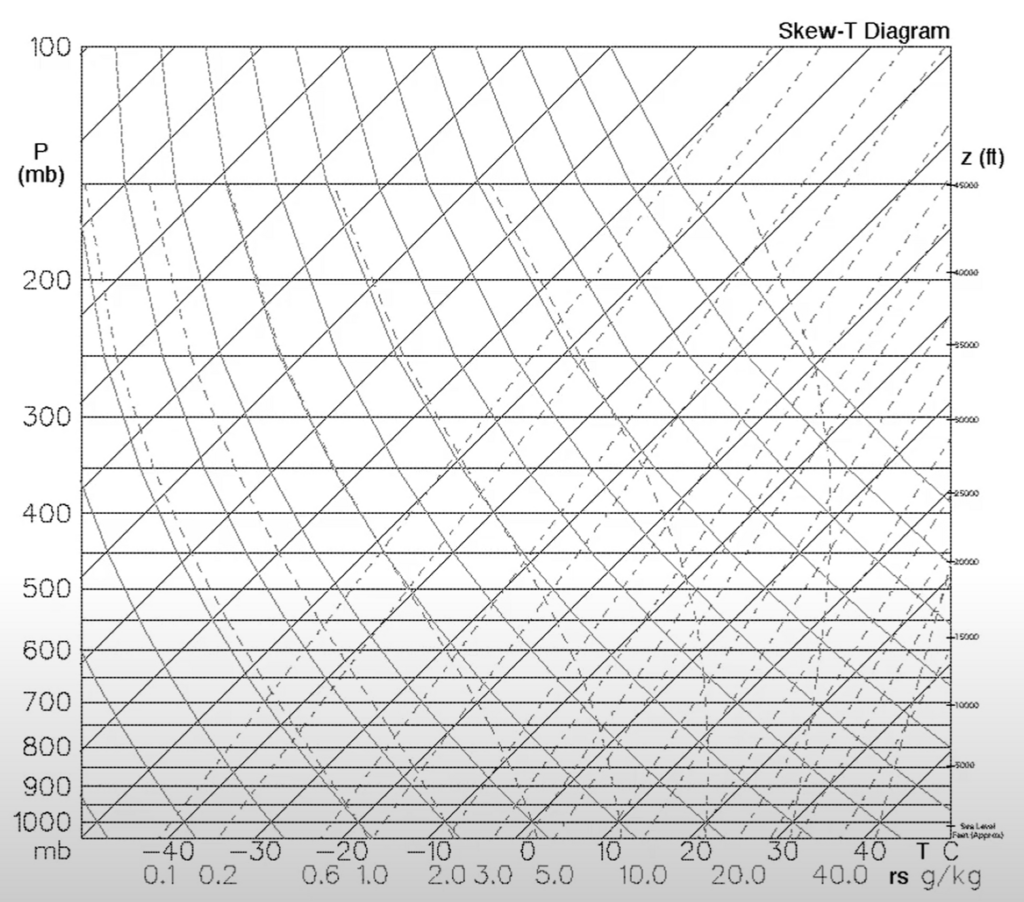
On this diagram, pressure is on the vertical axis (logarithmic scale) and temperature is on the horizontal axis, but skewed at a 45-degree angle. This clever design makes key processes easier to see.
Dry adiabats (lines of constant potential temperature) are nearly straight lines, while moist adiabats are curved. By plotting a temperature profile and lifting a surface air parcel along the appropriate adiabat, a forecaster can quickly assess stability and predict things like the height of cloud bases and tops, and the potential for severe weather.
In the context of atmospheric thermodynamics, what is the concept of an 'air parcel'?
Why is potential temperature () a more useful tracer for air masses than actual temperature?