Ancient and Modern Egypt
Geography of Egypt
Where Two Continents Meet
Egypt sits at a unique crossroads, connecting northeast Africa with southwest Asia. This strategic position has shaped its history for millennia. It's bordered by Libya to the west and Sudan to the south. To the northeast, it shares a border with Israel and the Gaza Strip. Two major bodies of water define its coastline: the Mediterranean Sea to the north and the Red Sea to the east.
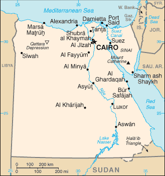
This location gives Egypt control over two critical maritime passages. The Suez Canal, a man-made waterway, connects the Mediterranean Sea to the Red Sea, creating the shortest sea link between Asia and Europe. The Sinai Peninsula, a triangular piece of land, acts as the physical bridge between the two continents.
Desert and River Valley
Egypt's landscape is a study in contrasts, dominated by vast deserts on either side of a single, life-giving river. Over 90% of the country is part of the Sahara Desert. This arid land is divided into two main sections: the Western Desert and the Eastern Desert.
The Western Desert, west of the Nile, is a massive expanse of sand dunes and rocky plateaus. It's also home to several large depressions, areas that dip below sea level, such as the Qattara Depression.
The Eastern Desert stretches from the Nile to the Red Sea. It is more mountainous than its western counterpart, featuring a rugged range of hills that run parallel to the Red Sea coast.
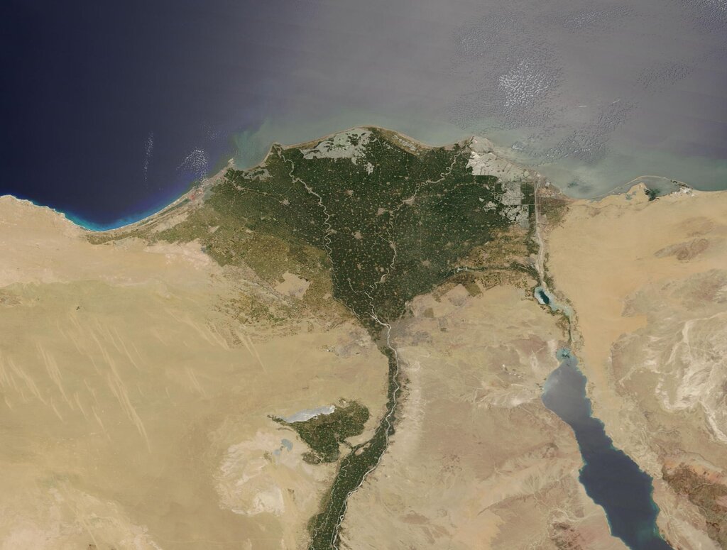
Cutting through this desert is the fertile Nile River Valley. This narrow strip of green, lush land has been the heart of Egyptian civilization for thousands of years. As the river flows north towards the Mediterranean, it fans out into the Nile Delta, a broad, triangular region of rich agricultural land where most of Egypt's population lives.
A Hot, Dry Climate
Egypt's climate is overwhelmingly hot and dry. Most of the country receives less than 80 millimeters of rain per year, making it one of the driest places on Earth. The majority of this sparse rainfall occurs along the Mediterranean coast during the winter months.
The country generally has two seasons: a very hot summer from May to October and a mild winter from November to April. In the spring, a phenomenon known as the khamsin can occur. This is a hot, dry, sand-filled wind that blows in from the southern deserts, sometimes causing sandstorms and a sharp rise in temperature.
| City | Avg. Summer High (July) | Avg. Winter High (Jan) | Avg. Annual Rainfall |
|---|---|---|---|
| Cairo | 34°C (93°F) | 19°C (66°F) | 25 mm |
| Alexandria | 30°C (86°F) | 18°C (64°F) | 200 mm |
Resources from Land and Water
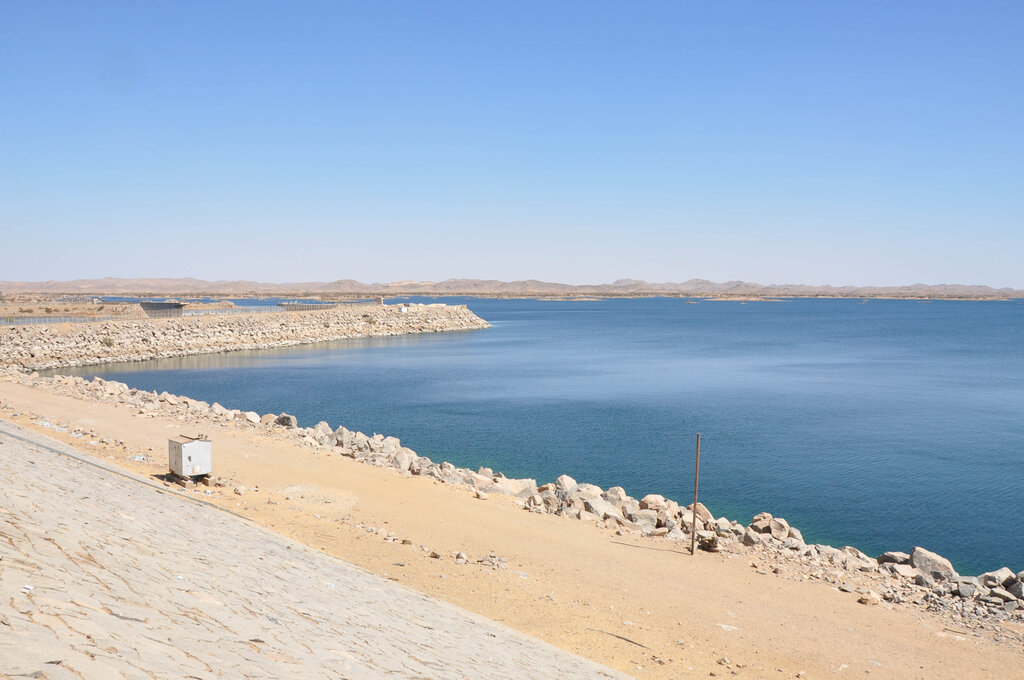
The Nile River is Egypt's most vital resource. For centuries, its predictable annual floods deposited fertile silt along its banks, creating ideal conditions for agriculture. Today, the Aswan High Dam controls the river's flow, preventing floods and generating hydroelectric power. The dam also created Lake Nasser, one of the world's largest artificial lakes, which provides a significant source of fresh water.
Beyond the Nile's gifts, Egypt has other natural resources. The country has significant reserves of petroleum and natural gas, primarily in the Western Desert and offshore in the Mediterranean Sea and the Gulf of Suez. It is also a source of minerals like iron ore, phosphates, manganese, and limestone, which is used heavily in construction.
Despite its vast desert, nearly all of Egypt's agriculture is concentrated in the less than 4% of land that makes up the Nile Valley and Delta.
Ready to test your knowledge? Let's see what you've learned about the geography of Egypt.
Which two major bodies of water define Egypt's coastline?
The fertile strip of land where most of Egypt's population lives is known as the __________.
From its strategic position linking continents to the stark duality of its desert and river landscapes, Egypt's geography is the foundation upon which its long and rich history has been built.