AI in Geospatial Science
Introduction to AI
What Is AI Anyway?
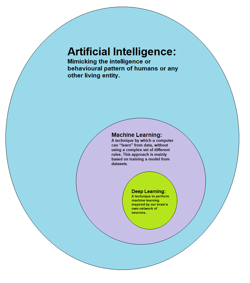
Artificial Intelligence, or AI, is about making computers think and learn like humans. It's not about creating sentient robots from movies. Instead, it's about teaching a machine to recognize patterns, make decisions, and solve problems.
Think of it like teaching a child. You don't give a child a massive rulebook for identifying a cat. They learn by seeing many examples of cats. AI works similarly. By processing vast amounts of data, a computer can learn to perform specific tasks, from understanding spoken language to identifying objects in a photo.
A Quick Trip Through Time
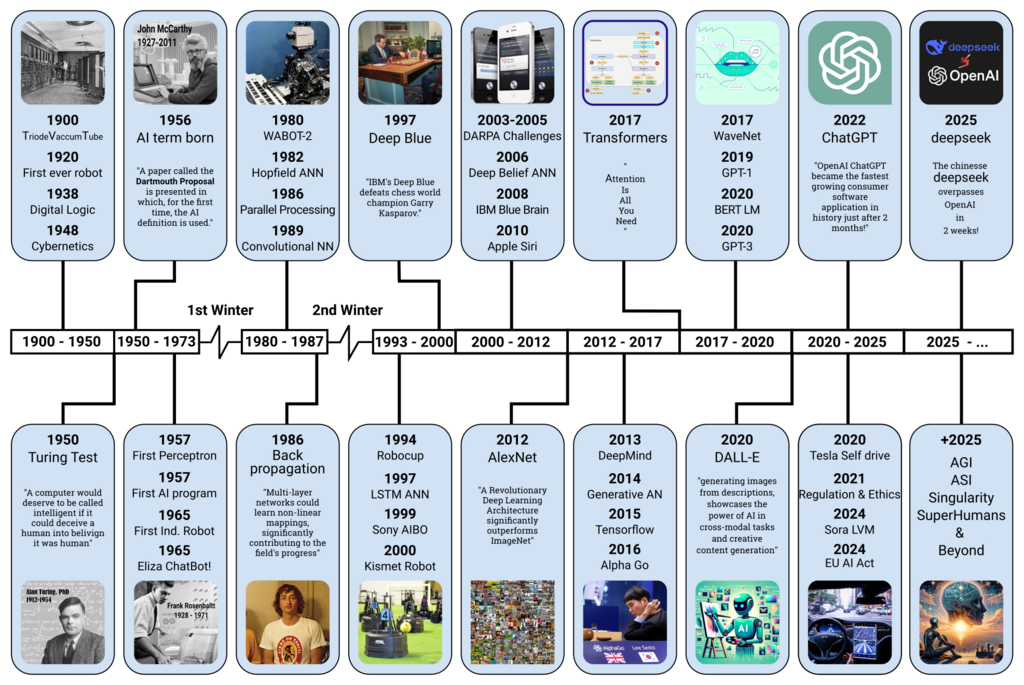
The idea of AI isn't new. The term was first coined in the 1950s, but the concept has roots going back much further. Early AI was mostly theoretical, limited by the computing power of the time. Progress came in waves, with periods of exciting breakthroughs followed by times of slower development.
In recent decades, two things changed the game: the availability of massive datasets (thanks to the internet) and the development of powerful, faster computers. This combination has fueled the rapid advancements we see today, making AI a part of our daily lives, from a smartphone's photo app to navigation systems.
AI Meets Geography
So, what happens when we combine the power of AI with geography? We get Geospatial AI, or GeoAI. This field focuses on using AI to analyze data that has a location component. Every time you ask for directions, check the weather, or see a map of local businesses, you're interacting with geospatial data.
GeoAI helps us make sense of the complex patterns and relationships that exist in the world around us. It's like giving AI a map and a compass, allowing it to understand not just what is happening, but where it's happening. This adds crucial context that traditional AI might miss.
GeoAI encompasses the development and application of AI techniques to analyze and understand geographically relevant information like spatial patterns, temporal trends, and relationships between locations.
Two core areas of AI are especially important in geography: Machine Learning and Computer Vision.
Machine Learning
noun
A type of AI that gives computers the ability to learn from data without being explicitly programmed. The system identifies patterns and makes predictions based on the information it's trained on.
Imagine trying to predict where a wildfire might spread. With machine learning, a model can analyze decades of data on past fires, including weather conditions, vegetation types, and terrain. It learns the patterns that lead to rapid fire spread and can then create a forecast for a current fire, helping emergency responders make better decisions.
Computer Vision
noun
A field of AI that trains computers to interpret and understand information from digital images, videos, and other visual inputs.
Satellite and drone imagery provide a constant stream of visual data about our planet. Computer vision allows us to process this information at a scale no human could manage. It can automatically detect changes in land use, such as a forest being cleared for farming, or identify every building in a city to create a detailed, up-to-date map.
Now that you have a grasp of the basic concepts, let's test your knowledge.
What is the primary goal of Artificial Intelligence, as described in the provided text?

Quiz Completed
0/1
Questions answered correctly
By understanding these fundamental ideas, you're ready to explore how AI is specifically applied to solve real-world geographical problems.