Advanced Post-Representational Cartography
Contemporary Cartographic Debates
Maps in Action
We often think of maps as static documents, neutral pictures of the world. But modern cartography sees them differently. A map isn't just something you look at; it's something you do something with. This is the idea behind performative cartography. The map becomes a tool for action, a script for navigating, planning, or even arguing.
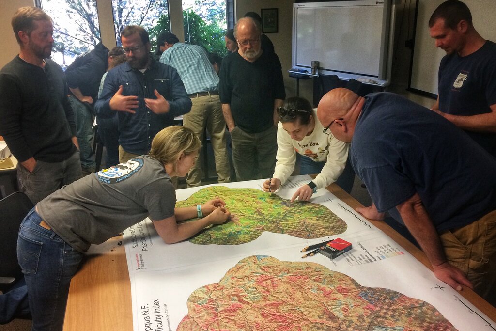
Imagine a community group gathered around a map of their neighborhood. They aren't just observing it. They're drawing new bike lanes, marking unsafe intersections, and outlining a new park. The map is a dynamic space for conversation and change. It performs a role in their advocacy.
This leads directly to participatory mapping. Instead of a single expert creating a map from on high, communities are increasingly involved in the process. People contribute their local knowledge, creating richer, more democratic maps that reflect lived experiences. Digital tools have supercharged this trend, allowing for widespread collaboration on projects from tracking local wildlife to identifying areas in need of city services.
The Digital Frontier
Digital technology has fundamentally changed what a map can be. Paper maps are a single snapshot in time. Digital maps are alive. They can be interactive, multilayered, and updated in real time. Think of the traffic layer on your phone's navigation app. It’s a map that constantly redraws itself to reflect the world as it is right now.
This dynamism allows for Geographic Information Systems (GIS), where different datasets are layered on top of a base map. A city planner could overlay zoning regulations, property values, and public transit routes to make a more informed decision. This ability to see complex relationships spatially is a massive leap from a simple road map.
Now, Artificial Intelligence (AI) is pushing the boundaries even further. AI can analyze satellite imagery to identify changes in land use, predict traffic patterns, or even generate maps of unmapped areas after a natural disaster. Instead of just displaying data, AI helps us interpret it and make predictions.
Due to their characteristics including world knowledge and generalizability, artistic style and creativity, and multimodal integration, we envision that GenAI may benefit a variety of cartographic design decisions, from mapmaking (e.g., conceptualization, data preparation, map design, and map evaluation) to map use (such as map reading, interpretation, and analysis).
New Tools, New Questions
These powerful new tools don't come without challenges. The rise of digital and AI-powered cartography brings a host of ethical questions to the forefront. Who owns the data that fuels these maps? How do we protect the privacy of individuals when location data is so easily collected?
Algorithms are not neutral. They are trained on data, and if that data is biased, the maps they create will be too. An algorithm designed to identify “blighted” neighborhoods for redevelopment might reflect historical prejudices rather than objective facts. This can have real-world consequences for the people living there.
This is why transparency and accountability are so critical. We need to understand how these mapping tools work, what data they use, and what assumptions are baked into their code. The goal is to ensure that maps serve everyone, not just the people who have the power to create them.
Here's a quick look at some of the core ethical debates:
| Ethical Issue | Key Question |
|---|---|
| Data Privacy | How can we use location data for public good without compromising individual privacy? |
| Algorithmic Bias | Are the algorithms used to create maps reinforcing existing inequalities? |
| Commodification | Who profits from the vast amounts of geographic data being collected? |
| Digital Divide | Who has access to these new mapping tools, and whose voices might be left out? |
Engaging with these questions is not just for professional cartographers. As we all become map-makers and users in this digital age, understanding the power and pitfalls of modern mapping is essential for responsible citizenship.
The concept of "performative cartography" reframes a map not just as a representation of a place, but as a...
What is a primary advantage of participatory mapping?
Contemporary cartography reminds us that a map is never just a map. It's a conversation, a tool, and a reflection of our values.