Advanced Dimensions of Indian Geography
Regional Geomorphology and Infrastructure
The Mountain Challenge
Building in the Himalayas is a constant negotiation with the Earth. These are geologically young, 'fold' mountains, meaning they are still rising and settling. This inherent instability presents immense challenges for creating durable infrastructure like highways and tunnels.
Engineers here aren't just battling steep gradients; they're contending with active fault lines and frequent seismic tremors. A road carved into a mountainside must account for the constant threat of landslides, while a tunnel has to be designed to withstand ground-shaking forces. This is where meticulous becomes critical. Planners use these zones to dictate building codes and material requirements, essentially creating a rulebook for how to build safely in an earthquake-prone landscape. Every bridge pier and tunnel lining is an exercise in managing calculated risk.
The Plains Advantage
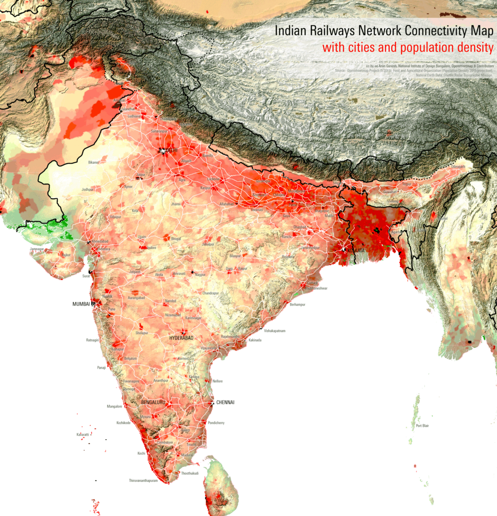
In stark contrast to the mountains, the Indo-Gangetic Plains offer a forgiving canvas for large-scale infrastructure. This vast, flat alluvial expanse, built up over millennia by river deposits, is a railway engineer's dream. Laying track requires minimal earthmoving, and long, straight routes can be plotted with relative ease, connecting the agricultural heartland to industrial centers and ports.
This topographical gift has allowed for one of the most extensive rail networks in the world. However, the plains have their own challenges. The same rivers that created this fertile land are prone to massive seasonal flooding, which can wash away track ballast and undermine bridges. Rail logistics must therefore incorporate elevated tracks in flood-prone areas and sophisticated drainage systems to ensure year-round connectivity.
Plateaus and Coasts
The Peninsular Plateau, particularly the , presents a different set of problems. This region is composed of hard, basaltic rock formed from ancient volcanic flows. While this provides a stable foundation, it's also difficult and costly to excavate for transport corridors or irrigation canals. The undulating, rugged terrain means that roads and railways must follow winding paths, increasing both distance and construction costs.
India's long coastline is an economic engine, but it's a dynamic and often aggressive environment. Port infrastructure must contend with coastal erosion, a process intensified by storms and rising sea levels. A major factor is —the movement of sand and sediment along the coastline by waves and currents. If a new harbor or breakwater is built, it can interrupt this natural flow, causing sand to build up in one area and erode disastrously in another. Engineers must design ports that work with coastal processes, using structures like groynes and sea walls not just to protect the harbor, but to manage the wider impact on the shoreline.
Every geographical region in India, from its highest peaks to its flattest plains, imposes its own set of rules on how humanity can build, connect, and thrive.
Why are the Himalayas considered a particularly challenging environment for constructing highways and tunnels?
In the context of coastal engineering in India, what is 'littoral drift'?
Each of India's physical divisions offers a unique blend of opportunities and constraints, forcing a constant trade-off between the drive for development and the realities of the landscape.