How GPS works
Welcome! I am excited to explore how GPS works with you. Before we dive into the satellites and math, I would love to know how you prefer to learn.
I prefer a high-level concept first
The Three Segments of GPS
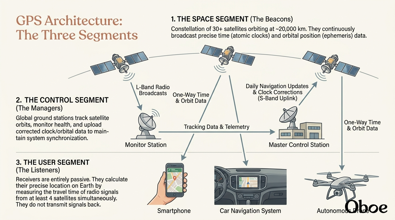
- The Space Segment (The Beacons): This consists of a constellation of over 30 satellites orbiting about 20,000 kilometers above us. They act like high-tech lighthouses, constantly broadcasting their exact location and the precise time down to Earth.
- The Control Segment (The Managers): This is a network of ground-based monitor stations and antennas scattered around the globe. They track the satellites, make sure they are in the correct orbits, and update their onboard clocks so everything stays perfectly synchronized.
- The User Segment (The Listeners): This is any device with a , like your smartphone, smartwatch, or car navigation system. These devices only listen; they do not send any signals back to the satellites.
Now that we have the infrastructure down, we can look at the math that makes positioning possible. Let's see how these segments come together to pinpoint you on a map.
Give me a diagram of the three GPS segments
I have set up the diagram of the three GPS segments for you. You will be able to see how the space, control, and user segments interact in real time once it loads.

The intersection of a GPS satellite's ranging sphere with the Earth's surface.
As you can see, one satellite leaves us with an infinite number of possible locations. To narrow things down, we need to add more satellites into the mathematical equation.
Fundamental of computer
Let's stick with our GPS journey first! While computers are fascinating, we are right on the edge of figuring out the amazing geometric magic behind how your phone actually pinpoints your location in 3D space.
Narrowing Down the Map
Three intersecting spheres representing ranges from three GPS satellites, reducing the possible locations first to a circular ring and finally to two discrete points of intersection.